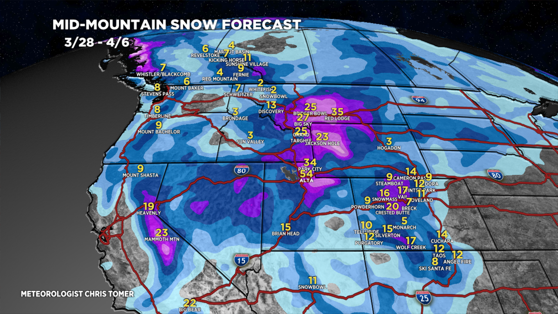
Tomer’s Take: Big totals are likely through 4/6 with 3-4 different storm systems, and I think we’re looking at an active April with above normal snowfall across parts of Colorado’s Western Slope, Utah’s Wasatch, and Wyoming’s Tetons.
Timing
Wasatch: L/M Tonight, L PM 3/29, H 3/30 – AM 4/1, H PM 4/4-4/6.
Tetons: M 3/30, H 3/31, H 4/4-4/5.
Colorado: H Late 3/28-3/29, L 3/30, H 3/31, L 4/1, H 4/6-4/7.
Sierra: H 3/29 – AM 4/1, M 4/4.
Northeast: H 4/2-4/5.
My afternoon forecast video update:
Current Setup
Water vapor satellite shows the next two areas of low pressure through 4/2. After 4/2, the northern jet buckles and delivers 1-2 additional storm systems through 4/6.
Moisture aloft = white/blues.

Forecast Radar & Satellite
Forecast Totals
Grand totals by late 4/6.


Northeast:
Heavy snow potential 4/2-4/5.
