Tomer’s Take: It’s a powder day across the Tetons with over a foot of new snow in 24hours. Now, this storm system slides south through the Wasatch 3/7 and into Colorado 3/7-3/8 departing early 3/9. Then the pattern shifts north to favor the PNW/BC/Northern Tier 3/9-3/12. Pattern shifts back south 3/12-3/15 with moderate to heavy snow for UT/WY/CO.
Timing
*Updated 3:45pm 3/6/2024.
Wasatch gets 3-6 inches overnight-3/7. Then heavy PM 3/11-3/13.
Tetons 1-2″ Tonight, H 3/11-3/13.
Colorado L/M 3/7-3/8, M/H 3/12-3/15.
Northeast Heavy Rain Tonight-3/7, Snow Late 3/9-3/10.
My afternoon forecast video update:
Forecast Radar & Satellite
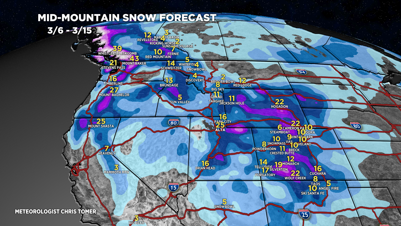
Forecast Totals
Forecast Grand Totals by late 3/15.


Northeast:
VT/NH/ME: Heavy rain PM 3/6-3/7. Heavy snow 3/10-3/11.
