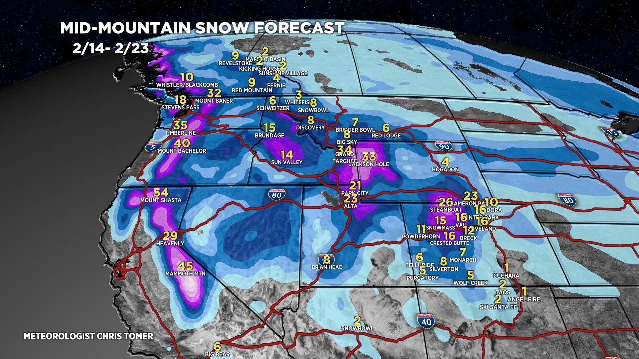
Tomer’s Take: Storm systems hit the West Coast through 2/23 and pieces break off and hit UT/ID/MT/UT/CO. There are a few snow bullseyes including the Tetons, Sierra, NW Colorado, and Wasatch with feet of grand total accumulation.
My afternoon forecast video update:
Jackson Hole is reporting 16″ in 24 hours. I’m forecasting another 2 feet (at least) through 2/23.

Snow Timeline
Tetons: Now-2/16, 2/18-2/20.
Sierra: PM 2/14 – AM 2/15, 2/17 – AM 2/18, 2/19-2/20.
NW CO: PM 2/14-2/16, PM 2/18, 2/21.
Wasatch: 2/15, 2/18, 2/19-2/21.
Current Setup
Water vapor satellite shows a few different storm systems lined-up for the West.
Orange/red = drier air aloft.

Forecast Jet Stream
Forecast Radar & Satellite
Forecast Totals
Grand totals 2/14-2/23.


Northeast:
Snow: PM 2/15 – AM 2/16, 2/23.
