Tomer’s Take: The higher elevations of the Northeast get moderate to heavy snowfall late 11/26 into 11/27 (with rain at lower elevations). Snow levels start high around 2k-3k then drop with bulk of snow in northern VT, NH, ME. Out West, high pressure takes over through 11/29 then the pattern shifts with both jet streams delivering snow 11/30-12/5.
My forecast video:
Forecast Jet Stream
Valid 11/28. High pressure ridge remains in place through 11/29, but notice the shortwave trough sliding into CA. This low pressure will take a southern track and help break down the ridge.

Valid 12/1. Active flow with both jets. Notice the storm system sliding through UT/WY/CO. And, powerful flow into the PNW/BC.

Valid 12/5. Flow turns temporarily quiet, but notice the trough in the Pacific lurking.

Forecast Radar & Satellite
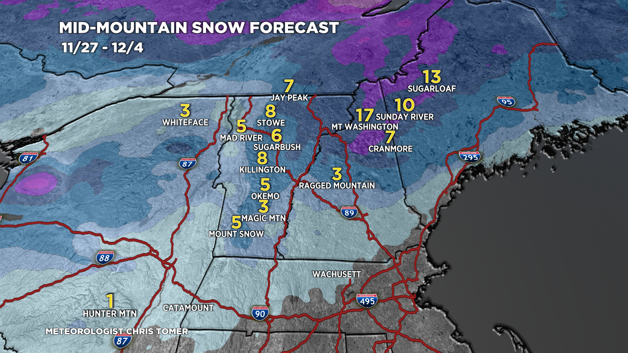
Forecast Totals
CO/NM Snow: 11/30, 12/1, 12/2, 12/3.

UT Snow: 11/30, 12/1, 12/2, 12/3, 12/4 (Bulk occurs 12/2-12/3)
WY Snow: 12/2-12/5.
PNW Snow: 11/30-12/7.

NE Snow: Late 11/26-11/27.
Snow levels run 2k-3k initially then drop.
