Tomer’s Take: What once looked like a significant snow event for CA has changed. Why? Weak atmospheric river (AR) contribution and poor trough trajectory.
Looking down the road, this initial trough will grease the skids for two additional areas of low pressure originating in the PNW that look more robust for the PNW, BC, ID, MT, WY, UT, CO between 11/18-11/22.
My forecast video:
Forecast Atmospheric River
Valid next 10 days from ECMWF, Integrated Vapor Transport (IVT) for 38N/123W (Around San Francisco coast).
Only looking at weak atmospheric river contribution 11/14-11/17.

Forecast Jet Stream
Valid 11/15. I sizable trough off the CA coast but it lacks atmospheric river contribution.

Valid 11/21. This impressive pattern appears to send robust moisture, cold air, and dynamics from the PNW/BC straight into the Interior Rockies.

Forecast Radar & Satellite
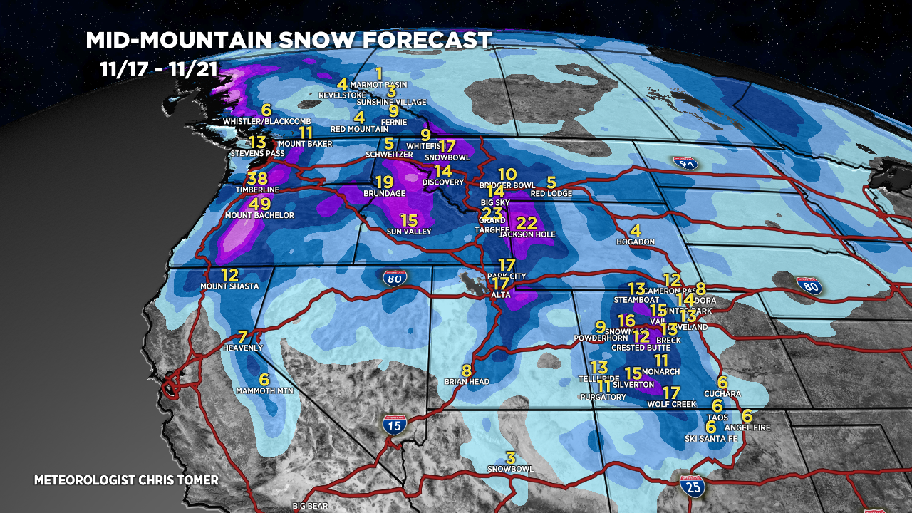
Forecast Snowfall


Thanks for all your hard work producing these forecasts!
Thanks, Kevin!