Tomer’s Take:
- La Nina continues to anchor the pattern across the West through mid-May. It’s the strongest April/May La Nina since 1999.
- I’m expecting above normal levels of wind, snow, and rain.
- Across the Intermountain West, a larger dip in the jet stream and trough of low pressure still possible 5/8-5/13.
- Conditions might ease the 2nd half of May.
Infrared satellite shows the active storm track and larger low pressure sitting in the Gulf of Alaska. This becomes the dominate force through 5/13.

5/8-5/13
Falling pressures are still possible with a dip in the jet stream between 5/8-5/13. Uncertainty remains high regarding precipitation placement. Of higher certainty is strong wind. A trough of this size would deliver abnormally strong wind across the Intermountain West.

Wind Gust Forecast 5/8-5/11
| Forecast (MPH) | 5/8 | 5/9 | 5/10 | 5/11 |
| Crestone Peak | 75 | 85 | 75 | 85 |
| Quandary Peak | 50 | 55 | 50 | 60 |
| Mount Wilson | 60 | 65 | 65 | 75 |
| Wheeler Peak | 50 | 55 | 50 | 50 |
| Kings Peak | 60 | 45 | 55 | 55 |
| Mount Whitney | 65 | 55 | 30 | 35 |
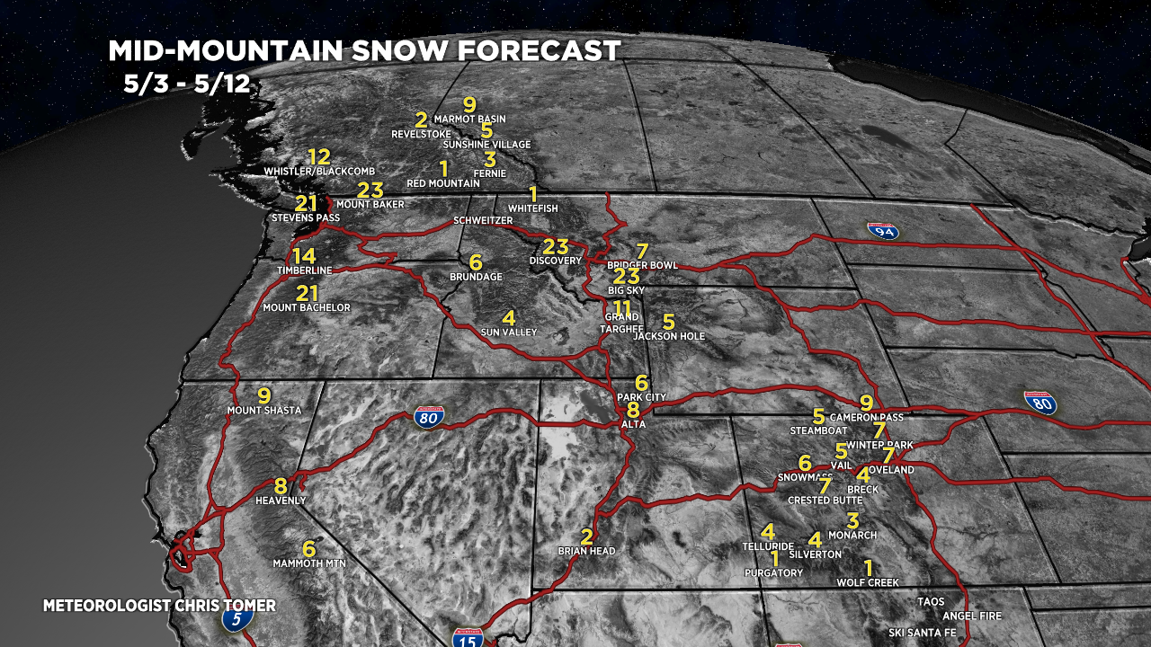
Snow Forecast
5/3-5/12:
