Tomer’s Take: A three storm cycle hits the West 1/6-1/13 with big totals and colder air. An Arctic blast could hit the Intermountain West on/about 1/13 with air temps running 30-40 degrees below normal. This trough runs 4-5 standard deviations below the 30 year average.
The Northeast benefits from all three Western storm systems. Moderate to heavy snow hits VT/NH/ME 1/6-1/7, heavy 1/9-1/10 with 70mph gusts (& rain/snow mix), moderate to heavy 1/12-1/13.
My afternoon forecast video update:
Current Setup
A small southern track low moves through CO/NM. Two large storm systems are lined-up in the north Pacific. Those are the pattern changing lows.

Forecast Jet Stream
Storm #1. Deep trough, snow, colder air.

Storm #2. Broad trough, snow, colder air.

Post Storm #3. Deep trough, Arctic Blast.

Arctic Blast
Valid on/about 1/13. Forecast air temperature anomalies vs 30 year averages.
Parts of the Intermountain West in purple run 30-40 degrees below normal.

Forecast Radar & Satellite
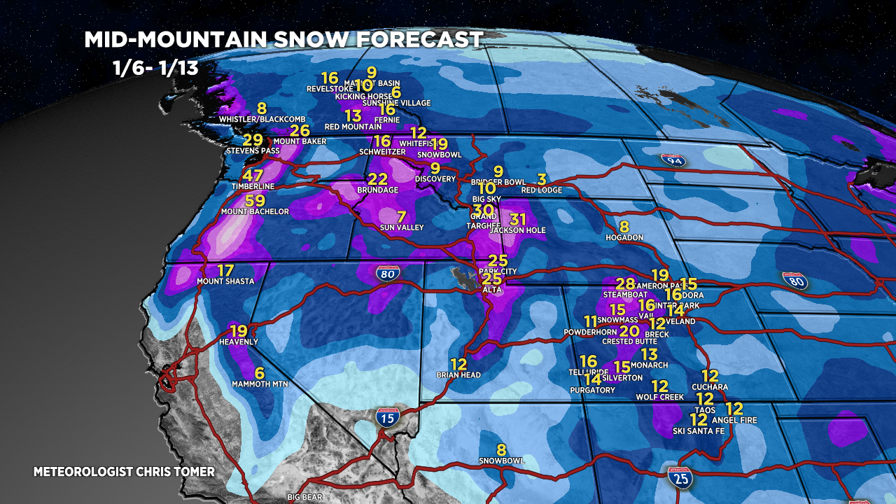
Forecast Totals
Light vanguard snow 1/5 ID/WY/MT/UT/CO.
Southern track low snow 1/4-1/5 CO/NM.

Storm #1 accumulation.

Storm #2 + Storm #3 accumulation.

Grand total accumulation 1/6-1/13 from Storm #1 + Storm #2 + Storm #3.

*Update 4:30pm 1/4.
VT/NH/ME/NY Grand Totals:
Storm #1: 1/6-1/7
Storm #2: 1/9-1/10
Storm #3: 1/12-1/13
