Tomer’s Take: Light to moderate snow is likely across Colorado’s mountains on 11/8-11/9 along with colder air. Then the Western pattern shifts with a large trough diving south from PNW/BC into CA on/after 11/13. The overall snowfall trend is down versus yesterday with less atmospheric river contribution.
7 inches of new snow in the last 24 hours at Park City, UT. Live view:

Current Setup
Infrared satellite shows the lurking trough and deep area of low pressure over the North Pacific. This will shift the Western Pattern.

Forecast Jet Stream
Valid 11/14. Notice the dip in the jet and area of low pressure off the CA coast.

Valid 11/17. The trough translates into the interior Rockies including UT, WY, CO.

Forecast Atmospheric River
The ECMWF is not as optimistic about the AR contribution versus 11/7.

Forecast Radar & Satellite
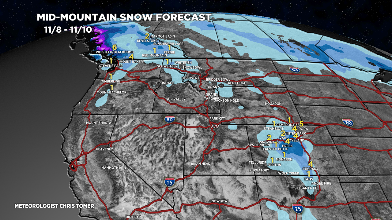
Forecast Snowfall
*Updated 2pm 11/8.
Valid 11/8-11/10. Light to moderate snow accumulation in CO.

*Updated 2pm 11/8.
Valid 11/11-11/7. Notice the substantial decrease in forecast snow for the Sierra and interior. A lack of an atmospheric river component is a big reason.
