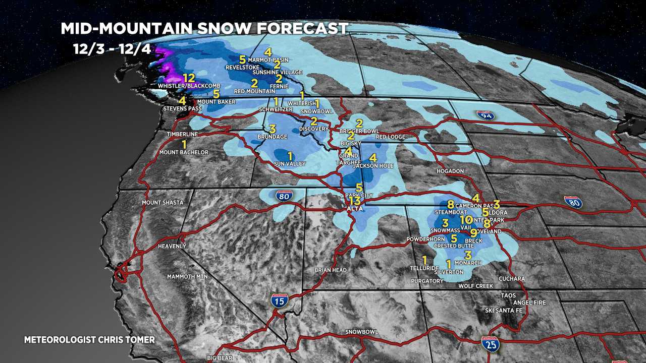
Tomer’s Take: WNW Flow continues to deliver snow in UT and CO through early 12/4 then drier. Light to moderate additional accumulation in ID, MT, WY. Brutally cold and windy above treeline in Colorado with 30-70mph gusts and single digit air temps. Then next storm system hits the Intermountain West 12/7-12/9. A strong intensity atmospheric river surge hits the PNW/BC 12/4-12/7 with copious amounts of valley rain and feet of higher elevation snow. Rainier could see 5 feet.
My forecast video:
Forecast Radar & Satellite
Forecast Totals
Remaining snow today/tonight, 12/3.


A more active period with 1-2 storm systems.

Bulk of snow arrives afternoon 12/3 through early 12/4.

Hey thanks man! finally a forecast for folks that dont live in cities! Farmers & ranchers, & folks off grid depend on real time forecasts.
Thanks, Michael!