Tomer’s Take: Snow continues early 1/18 in UT & WY and through midday in CO. Then the pattern shifts 1/19-1/26 to a warmer Pacific pattern with a strong Subtropical jet.
My afternoon forecast video update:
Current Setup
A storm system riding a WNW Flow continues in CO/WY/ID/MT/WA/BC.
Notice the large trough sitting over the Pacific. That is our next pattern for the West.
Orange/red = drier air aloft.

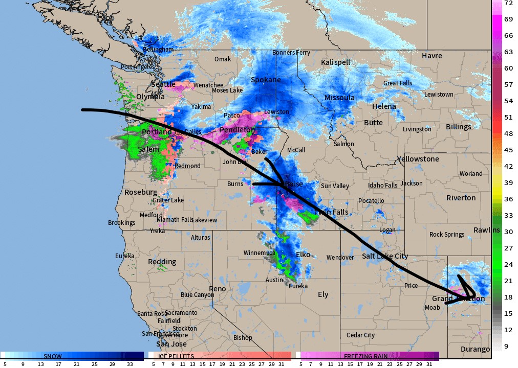
Radar at 2:35pm: Snow following WNW Flow.

Forecast Jet Stream
WNW Flow gradually exits moving East.

New warmer Pacific pattern engages 1/19-1/26. Strong Subtropical jet blows in waves of precipitation.

Forecast Radar & Satellite
Forecast Totals
Grand Totals remainder of 1/17 through 1/26.

Additional snowfall remainder of 1/17 through 1/18.


Chris,
Thanks so much for your hard work and brilliance.
Your’re incredible and keeping us all safe and psyched up about the snow season!
Thanks again.
Respectfully yours.
Steve Kraemer
Thanks so much, Steve! Chris