Tomer’s Take:
- A strong late-season dip in the jet stream could deliver snow 5/19-5/20 to MT, WY, and CO.
- Snow levels fall significantly to the valley floor in some locations. Frost/Freeze is also possible.
- Forecast atmospheric pressure anomalies could run 2-3 standard deviations from the 30-year average.
- Strong wind 30-80mph ahead of this storm system.
I took the skis out on Saturday near Torreys Peak in Colorado. It was a beautiful day and snow was melting quickly.

Current Setup
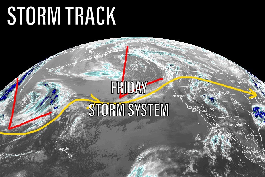
Infrared satellite shows the storm track and strong low pressure system pulling out of the Gulf of Alaska.

Late Season Anomaly
Below, this is a robust storm system and important by May standards. Forecast atmospheric pressure anomalies run 2-3 standard deviations from the 30-year averages.

Forecast Wind Gusts
| Gust (MPH) | 5/17 | 5/18 | 5/19 | 5/20 |
| Crestone Peak | 35 | 40 | 70 | 45 |
| Quandary Peak | 25 | 35 | 60 | 35 |
| Mount Sneffels | 35 | 35 | 50 | 55 |
| Kings Peak | 30 | 30 | 60 | 40 |
| Wheeler Peak | 30 | 35 | 55 | 55 |
| Grand Teton | 30 | 40 | 65 | 35 |
Snow Forecast
5/16-5/25:

We’re leaving tomorrow morning (Tuesday) for Yellowstone from the Vail area. Will we hit snow? What is the snow forecast around YS park? Thanks!
Hi Terry – yes, it looks like you’ll run into some snow on Thursday and Friday, especially as you get closer to the MT state line. Air temps turn colder on Thursday along with gusty wind. 20s and 30s on Friday and Saturday morning.