Tomer’s Take: A storm system with light to moderate snow accumulation continues 1/25-1/26 ID/UT/WY/CO/NM. Then high pressure builds over WY/UT/CO/NM 1/27-1/31 with abnormally warm temps. The PNW rain/snow line increases from 5k to 8k (or higher). The pattern turns more active the first week of February with a large trough and powerful Subtropical jet.
My afternoon forecast video update:
Current Setup
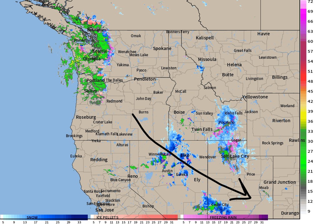
Radar shows energy diving SSE through ID/UT/NV/WY/CO/NM.

Forecast Rain/Snow Line
Mount Baker, WA (Min/Max):
1/25: 3900’/4500′
1/26: 5700’/6500′
1/27: 7000’/8000′
1/28: 7000’/9000′
1/29: 7500’/8000′
Mount Bachelor, OR:
1/25: 4500’/5500′.
1/26: 8000/8700′.
1/27: 8200’/8700′.
1/28: 9000’/10000′.
1/29: 9000’/10000′.
Forecast Jet Stream
Storm system departs CO/NM 1/26. Then ridge of high pressure builds into UT/ID/WY/CO/NM 1/27-1/31.

First Week of February
Strong Subtropical jet stream escorting a couple different storm systems. Trend is to push the stormtrack further south.

Forecast Radar & Satellite
Forecast Totals


VT/NH/ME:
Rain/Snow 1/26, Light Snow 1/27, Moderate Snow PM 1/28-1/29, Moderate Snow 2/2.

You’re the best Chris, thanks for doing these forecasts!
Interesting that kicking horse is projected to get more snow than Revelstoke for the first few days of Feb, that’s pretty rare. Is there some favourable orographics helping out? Is there a particular type of storm/track that you would expect to outperform at kicking horse?
Hi Brett, things might’ve changed with this afternoon’s update, and we’re fighting abnormally warm air. The rain/snow line jumps to like 6k-7k. The flow is richer for Revelstoke through 1/30 with heavy snow at the highest elevations. Flow is about even for both Revelstoke and Kicking Horse 1/31-2/3. We’ll see what things look like tomorrow. Chris
Thanks for continuing to include the northeast. Hope ur doing well.
Thanks, Kevin!