Tomer’s Take: The pattern favors two distinct snow bullseyes through 2/22: Sierra & Tetons with feet of grand total accumulation.
Overall, it’s a pattern dominated by storm systems hitting the West Coast then weakening and sending pieces of energy/precip into the Intermountain West.
My afternoon forecast update video:
Snow Timeline
Tetons: Now-2/16, 2/18-2/20.
Wasatch: 2/14 (light), 2/15, 2/18, 2/20, 2/22.
Colorado C+N Zones: 2/14 – AM 2/17, 2/18-2/19, 2/20, 2/22.
Sierra: PM 2/14 – AM 2/15, 2/17 – AM 2/18, PM 2/18-2/19.
Current Setup
Water vapor satellite shows four different storm systems over the Pacific.
Orange/red = drier air aloft.

Forecast Atmospheric River
Forecast Integrated Vapor Transport (IVT) valid near the San Francisco coast (38N/123W) shows low-level/weak atmospheric river (AR) contribution with each storm system.

Forecast Jet Stream
Forecast Radar & Satellite
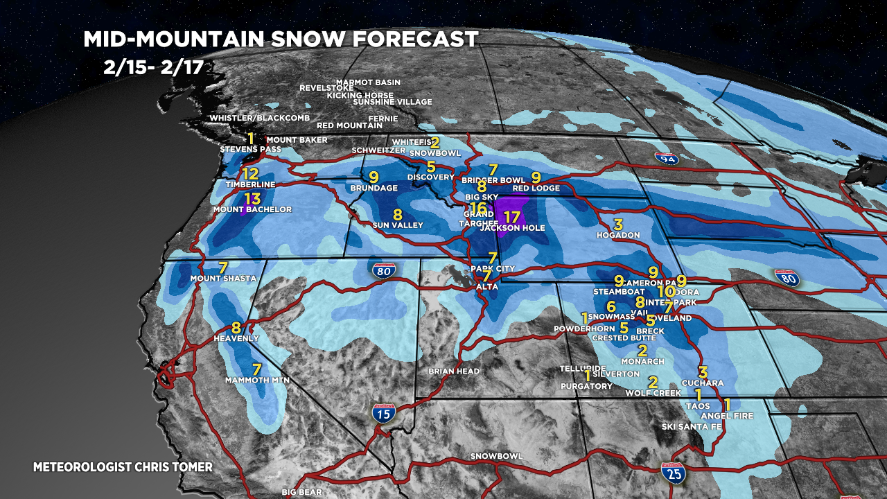
Forecast Totals


Thanks for the forecasts Chris. NWS here in slc and some other models are showing the trend higher for northern Utah thur and Friday storm. Interested to see if this trend continues in future runs. Showing 16” in lcc. Wait and see what shakes out.
Also seems like a lot lurking for next week in the pacific, hope it can make it around the sierras and hit Colorado.
T
Thanks, Todd! Numbers continue creeping up for the Wasatch…now thinking about two feet grand total. Chris