Tomer’s Take:
- A surge of Monsoon moisture is moving into Colorado.
- This means afternoon rain/t-storms are more likely through Monday.
- Precipitation chances for LT100 and Triple Bypass are increasing.
- Early and late precipitation is now possible especially in the Southern Mountains.
- Snow is possible both Saturday night and Sunday night on the 14ers. Light accumulations.
Current Setup
Water vapor satellite shows the current moisture surge moving north through AZ, NM, UT, and CO. Red/orange = drier air aloft.

Flash Flood Potential
Excessive rainfall outlook valid 8/19/2022.

Excessive rainfall outlook valid 8/20/2022.

Forecast
| LT100 Run | AM | PM |
| 8/19 | Dry | 80% |
| 8/20 | 10% | 90% |
| 8/21 | 10% | 90% |
Hourly forecast valid 8/20 in Leadville:
| Hour | 4am | 10am | Noon | 4pm | 9pm |
| % | Dry | 10% | 90% | 90% | 30% |
| Triple Bypass | AM | PM |
| 8/19 | Dry | 70% |
| 8/20 | 10% | 90% |
| 8/21 | 10% | 90% |
Hourly forecast valid 8/20 Loveland Pass to Vail Pass:
Air temps at Pass level (High/Low): 54/32F
| Hour | 4am | 10am | Noon | 4pm | 9pm |
| % | Dry | 10% | 90% | 90% | 30% |
| Sky | Cloudy | Cloudy | Storms | Storms | Clearing |
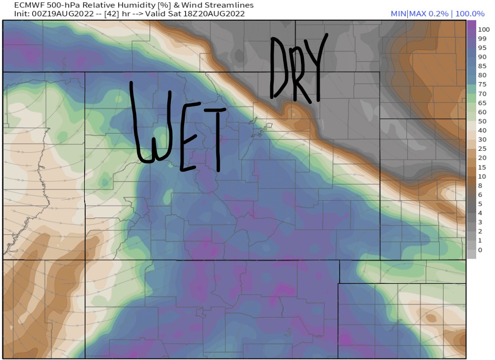
Compare the forecast images below for 8/20 from yesterday (Left Image) versus today (Right Image).
Notice the shift in forecast humidity. The northeast shift means rain/t-storms chances are now higher on 8/20.


14er Snow
| 14ers | Inches |
| 8/20 Night | 0-3″ |
| 8/21 Night | 0-3″ |
Here’s my mountain weather update 8/19:

Greetings to all the Tomer Tools out there. He is the MVM = MOST VALUABLE METEOROLOGIST
Stationed here in the Ohio Valley, we have seen the effects of the Colorado monsoons. The humidity has been turned off and rain is almost daily.
I came here today to hear the “S” word and Chris you have delivered once again! It’s just great to hear that word spoken.
Thanks for making videos and bloggin’.
Randall
Thanks, Randall! Almost that time again. Chris