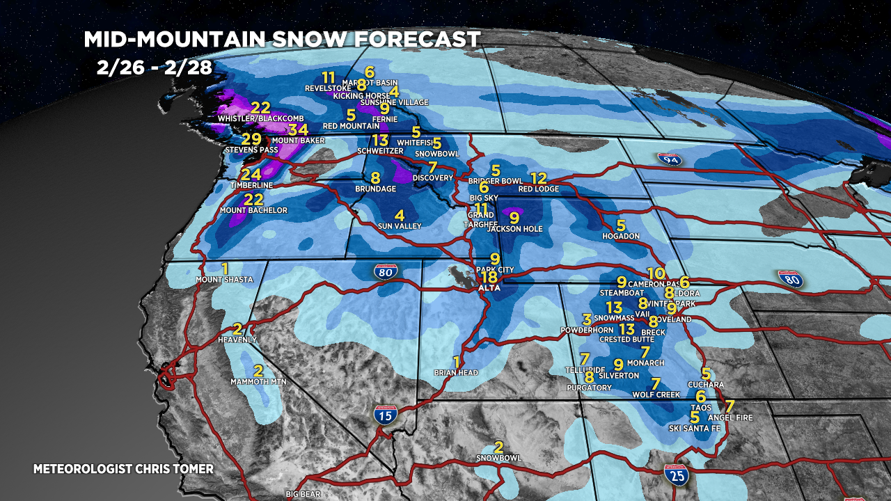
Tomer’s Take: A windy, robust quick strike storm system hits UT/WY/CO afternoon 2/26 through 2/27 with 9-18 inches. I trimmed some totals down another 20%. Storm #2 arrives 2/29-3/4 with heavy snow accumulation across most of the West. This is a bigger storm system.
My afternoon forecast video update:
Current Setup
Water vapor satellite shows the main storm system dropping south with the Northern Jet Branch into ID/MT/OR/WA. Next stop UT/WY/CO.
Orange/red = drier air aloft.
White/Blue = moisture aloft.

Forecast Radar & Satellite
Forecast Totals
Storm #1:
Trimmed Colorado’s numbers down 20%.
Ridgetop wind gusts 50-70mph likely UT/WY/CO.


Northeast:
VT/NH/ME rain 2/28 changing light snow late 2/28 into early 2/29. Another light snow chance 3/6.
