Tomer’s Take: Jackson Hole got blasted by 30 inches in the last 24 hours and another foot or more is on the way. This heavy band of snow hits the Wasatch between Lunch today and the morning of 3/3, and then Colorado tonight through 3/3. 50-80mph wind gusts are likely in CA/UT/WY/CO next 48 hours. Another storm system hits the West 3/5-3/8.
Timeline
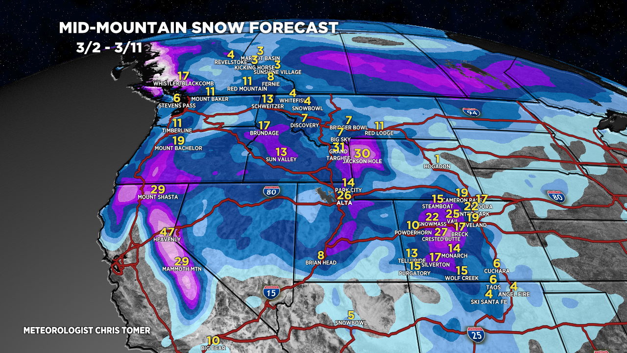
Updated 2:45pm 3/2/2024.
*Intense 12-18 hours in the Wasatch with roughly 1-2FT by AM 3/3 and 50-70mph gusts.
*Same heavy band of snow hits CO’s Central and Northern Mountain zones tonight – AM 3/3 with 50-80mph gusts.
*Tetons L/M Snow Ending Tonight, L/M PM 3/3-3/4, H 3/5-3/6.
Sierra 5-10 Feet Now – AM 3/5.
*Powder Highway, Canada 2-5″ Now – AM 3/4.
*Northeast Stormtrack Shift 3/7-3/8 now looking lighter.
My afternoon forecast video update:
Current Setup
Water vapor satellite shows the big initial storm system hammering the Sierra and now Tetons and later the Wasatch and Colorado Rockies through 3/3 with heavy snow accumulation.
Orange/red = drier air aloft.

Forecast Radar & Satellite
Forecast Totals
Forecast Grand totals by late 3/11.


Northeast:
VT/NH/ME heavy snow potential 3/7-3/8 if air temps are cold enough.
