Tomer’s Take: Major storm cycle lasts until 2/10. A storm system continues to spin in CA with heavy rain and Sierra snow. A powerful Subtropical jet is transporting moisture ahead of this storm system on 2/5 into UT/ID/WY/MT and into CO/NM on 2/6. Smaller pieces of energy will dive into the intermountain west behind this storm and keep the snow going through 2/8-2/10.
My afternoon forecast video update:
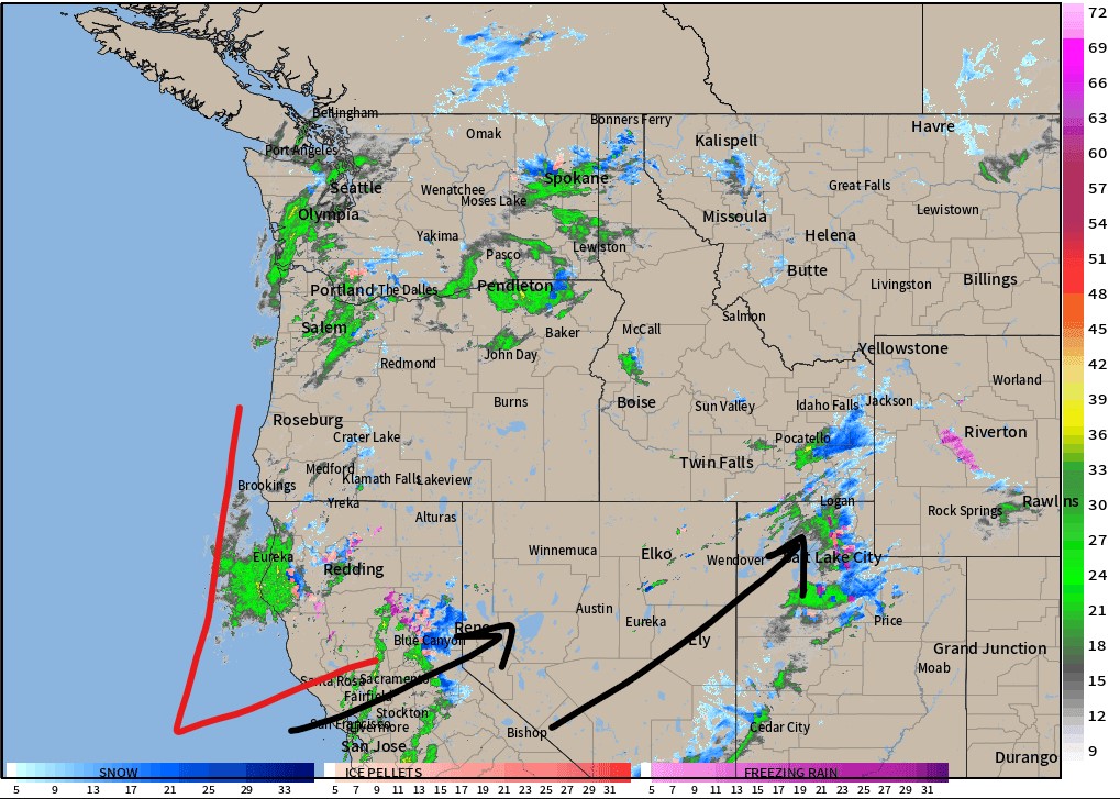
Current Setup
Radar shows the main storm system spinning in CA. Powerful transport jet wind carries moisture into UT/ID/WY/MT.

Flash flooding continues in Southern CA. Almost a foot of rain in places from a rich AR surge, storm system, and powerful Subtropical jet flow.

Precipitable water (PWAT) valid early 2/5. This is a measure of moisture in the atmosphere. Notice the green/lime plume (or finger) of higher PWAT values pointing directly at Southern California. This is a signature of the atmospheric river (AR) and it enhances precipitation.

Forecast Jet Stream
CA storm system and trough starts to move into the interior Rockies.

Broad trough, storm system and smaller pieces of energy roll through UT/WY/ID/AZ/CO/NM.

Forecast Radar & Satellite
Forecast Totals
CO Snow: 2/6-2/10, 2/14.
UT Snow: 2/5-2/9.
WY Snow: 2/5-2/8, 2/13.
Revelstoke Snow: 2/6-2/8, 2/12-2/13.


VT/NH/ME Snow: 2/9-2/10 (Light), 2/12-2/13.
