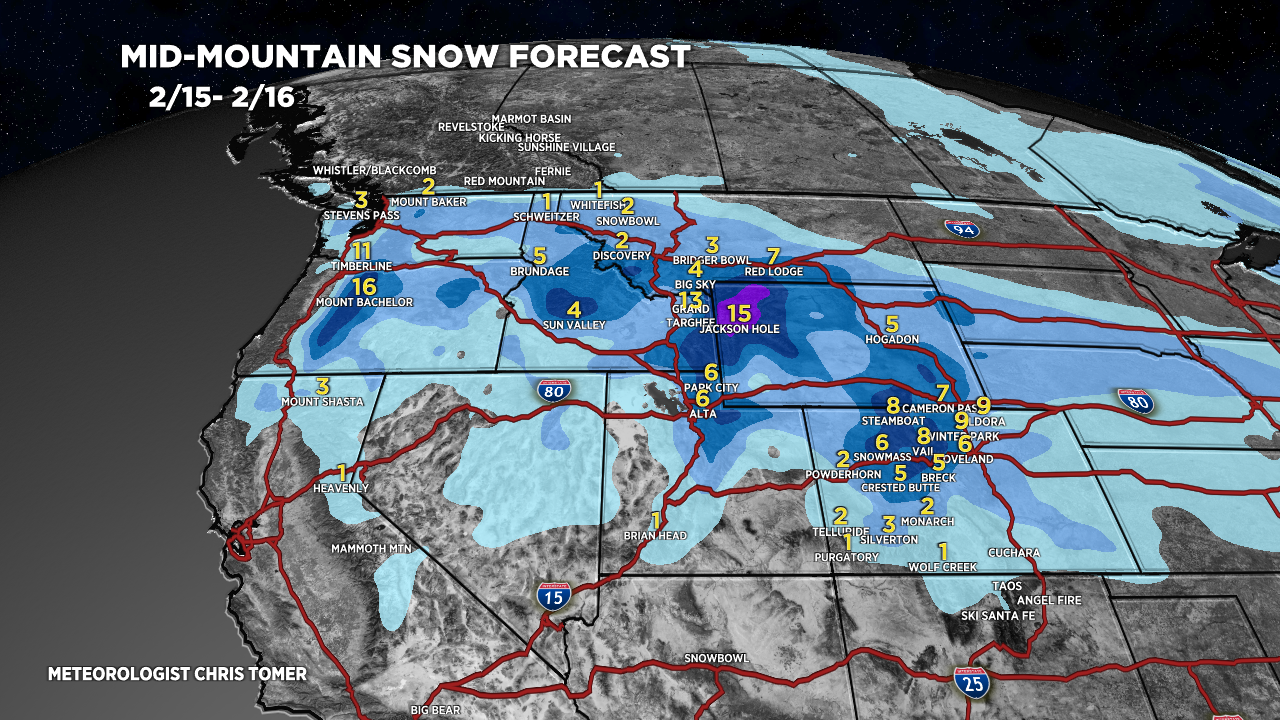
Tomer’s Take: The Teton snow bullseye continues next 48 hours with another 12-14 inches. That’ll be three feet in three days. I’m forecasting 6-8 inches today (2/15) across the Wasatch. In Colorado, I’m forecasting 4-8 inches across the Central and Northern Mountain zones 2/15-2/16.
My afternoon forecast video update:
Current Setup
Water vapor satellte shows the current storm system generating snow in UT/WY/CO/ID.
The larger trough of low pressure over the Pacific will move at snails pace sending ripples of energy into the Intermountain West through 2/22.
Orange/red = drier air aloft.

Forecast Jet Stream
Forecast Radar & Satellite
Forecast Totals


Northeast:
Snow: PM 2/15-2/16.
