Tomer’s Take: Two areas of low pressure deliver snow to UT/WY/CO 12/23-12/24. A major storm system hits the PNW/BC with heavy snow 12/25-12/26, and the Sierra might get heavy snow 12/29-12/30.
A storm system crosses the Intermountain West on/about 12/30-12/31 with light to moderate snow accumulation.
My forecast video:
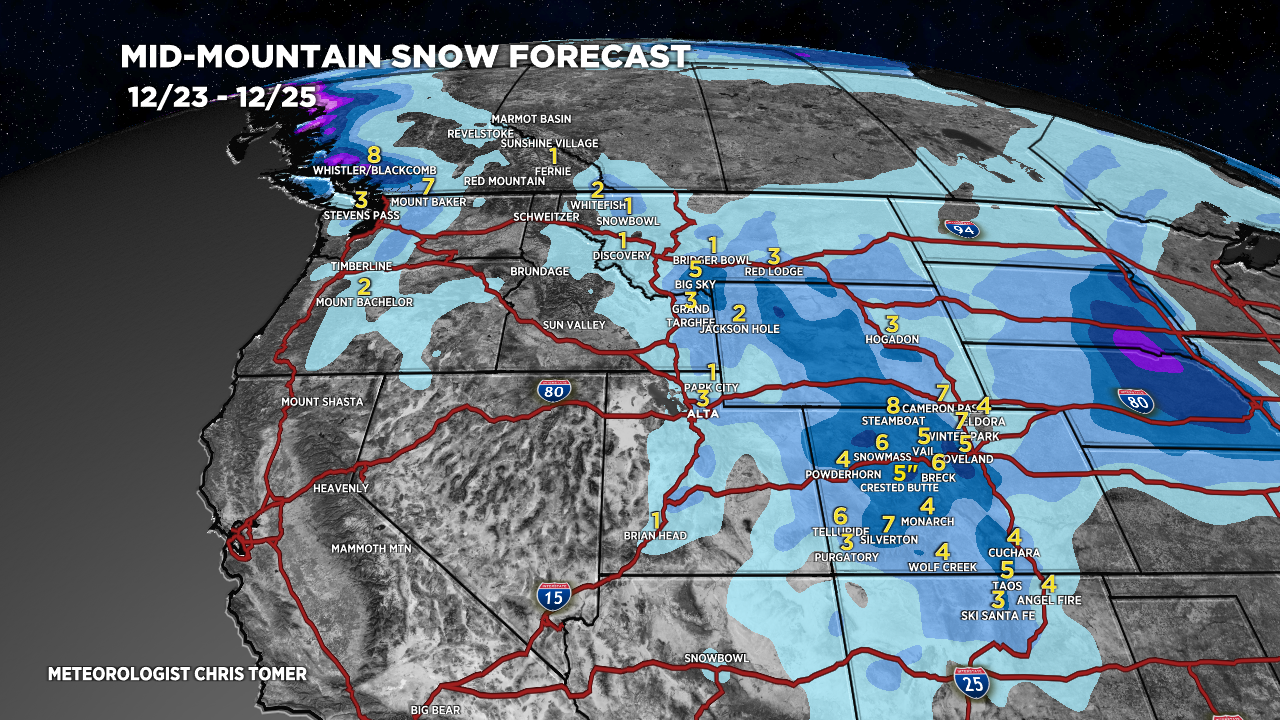
5″ in 24hrs at Alta, UT with another 1-3″ before the storm departs.

Current Setup
Water vapor satellite shows both areas of low pressure merging over UT/WY/CO.
An active Pacific jet inbound to PNW/BC.
Orange/red = drier air aloft.

Forecast Jet Stream
Forecast pattern 1/1/2024. Active flow with both northern and southern branches.

Forecast Totals
UT Wasatch: An additional 1-3 inches 12/23 then drier 12/24 (and beyond).
CO Snow: 12/23-12/24 & 12/30-12/31.


CA Snow: 12/27 (light), 12/29-12/30 (Heavy).

VT/NH/ME: Rain on 12/27 and it *might* change to snow 12/28. Light snow 12/30-1/1.

Merry Christmas to you and the family! Keep up the awesome updates.
Thanks, Brad! Merry Christmas
Merry Christmas, Chris!
Thanks, Judi! Merry Christmas
Merry Christmas! to all the TOMER faithful out there.
I’d like to send Chirs gifts of : lots of clouds, southern Lows, arctic blasts, and most importantly Pineapple Express blasts which are orographically aligned over the Inter-Mountain west.
Cheers to Loveland, Jackson Hole, Mt. Shasta, Alta, Brian Head, and all the other favorite Tomer spots.
Thanks, Randall! Merry Christmas