Tomer’s Take:
- High pressure rebuilds across the West 5/13-5/18. The storm track shifts into the PNW/B.C.
- Then pressures might drop with a large trough and dip in the jet stream 5/19-5/25.
- Beyond 5/25? High pressure might rebuild.
- What are the possible effects of a large trough 5/19-5/25? Colder than normal temps, mountain snowfall, and strong wind by May standards.
- Dust continues be a significant problem across parts of the West including UT and CO. New dust is being transported in as I write this column. The dust decreases snowpack albedo and accelerates snowmelt. This is likely the most dust since 2009.
Wasatch Dust
Look at the dust layers lurking in the Wasatch as presented by Dr. McKenzie Skiles:
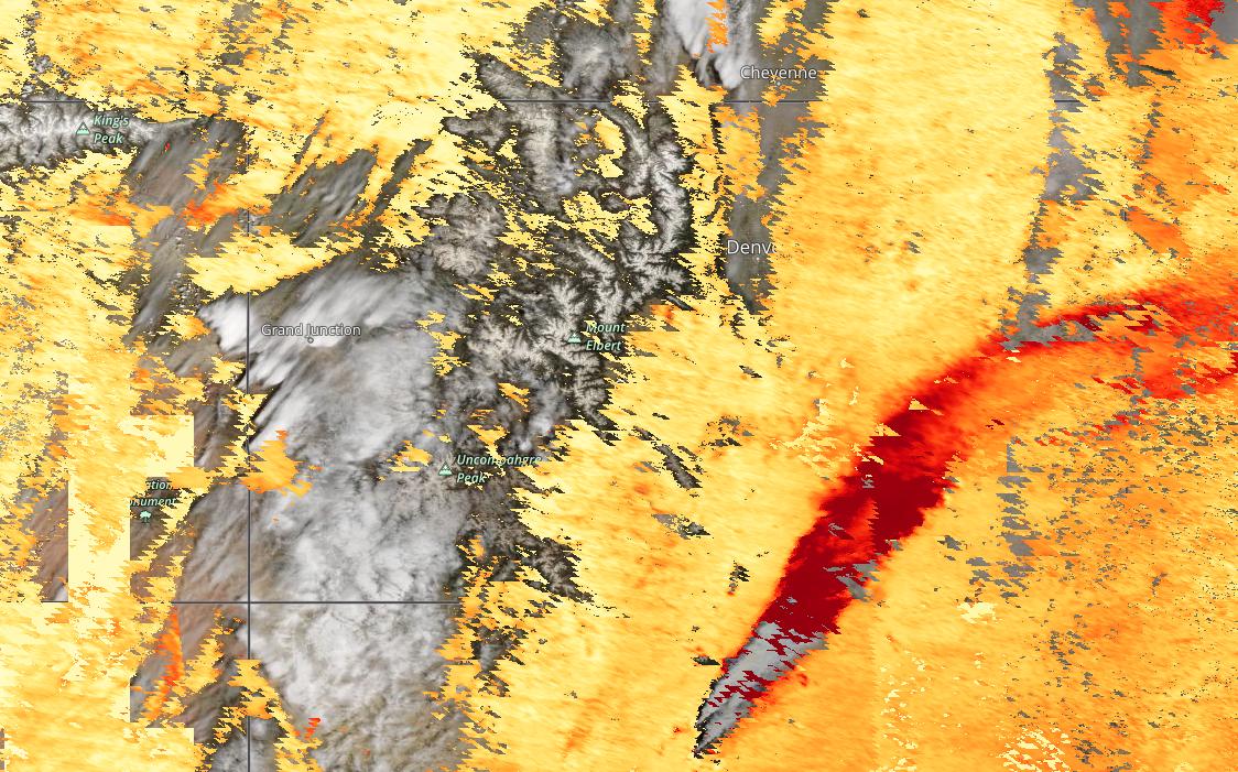
In Colorado, MODIS satellite with MAIAC Aerosol Optical Depth overlay really paints the smoky/dusty picture.

Current Setup
Infrared satellite shows the storm track and powerful jet stream running through the Intermountain West.

5/19-5/25
A large trough of low pressure is possible across the West. Below, notice the atmospheric pressure anomalies. After 5/25? High pressure might rebuild.

Wind Gust Forecast
Notice how winds relax as high pressure rebuilds 5/13 and after.
| Gust (MPH) | 5/12 | 5/13 | 5/14 | 5/15 |
| Little Bear Peak | 65 | 40 | 35 | 35 |
| Quandary Peak | 55 | 40 | 35 | 25 |
| Mount Sneffels | 55 | 30 | 30 | 25 |
| Kings Peak | 55 | 40 | 30 | 25 |
| Humphreys Peak | 40 | 25 | 35 | 35 |
| Grand Teton | 45 | 55 | 40 | 20 |
Snow Forecast
5/12-5/21:

Today’s new word: albedo
Thanks!!
Thanks, Leo!