Tomer’s Take: A trough of low pressure slides across UT/CO 2/21-2/22 with snow accumulation. Then the pattern shifts 2/25-3/1 with the northern jet branch buckling south into the Lower 48, delivering energy, WNW Flow, and merging at times with the southern jet branch. Big totals likely.
My afternoon forecast video update:
Forecast Timeline
*Updated 4:30pm 2/21.
Wasatch Snow Ends Tonight, Heavy 2/26-2/27.
Tetons Heavy 2/26-2/28.
Colorado Light/Mod Snow PM 2/21 – AM 2/22, Heavy 2/26-2/28.
Strong Wind 2/26-2/27.
Northern Branch Merger 2/26-2/27.
PNW/BC/Northern Tier 2/29-3/1.
Northeast Light/Moderate Snow 2/23, 2/28-2/29.
Current Setup
Water vapor satellite shows a storm system crossing UT/CO. A large trough in the North Pacific becomes part of the pattern shift 2/25-3/1 with the northern branch.
Orange/red = drier air aloft.

Forecast Jet Stream
Forecast Radar & Satellite
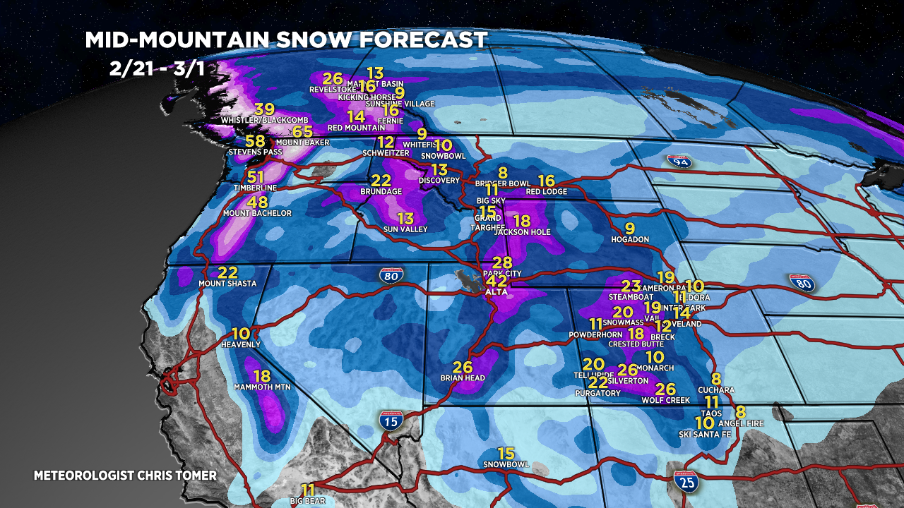
Forecast Totals
Grand totals by late 3/1.


Hi Chris, Burton Kloster from Park City checking in. It has been extremely warm yesterday and temps today should get into the 40s. We have blue sky and light snow falling, but temps now are 35 degrees.. Fingers crossed we get lots of snow, and we may get it at higher elevations, but from where I sit, the snow is melting. Feels like March. Oh well…
Hi Burton! Wasatch snow ends tonight then it’s dry until a major storm system arrives 2/26-2/27 with 1-3 feet. Chris