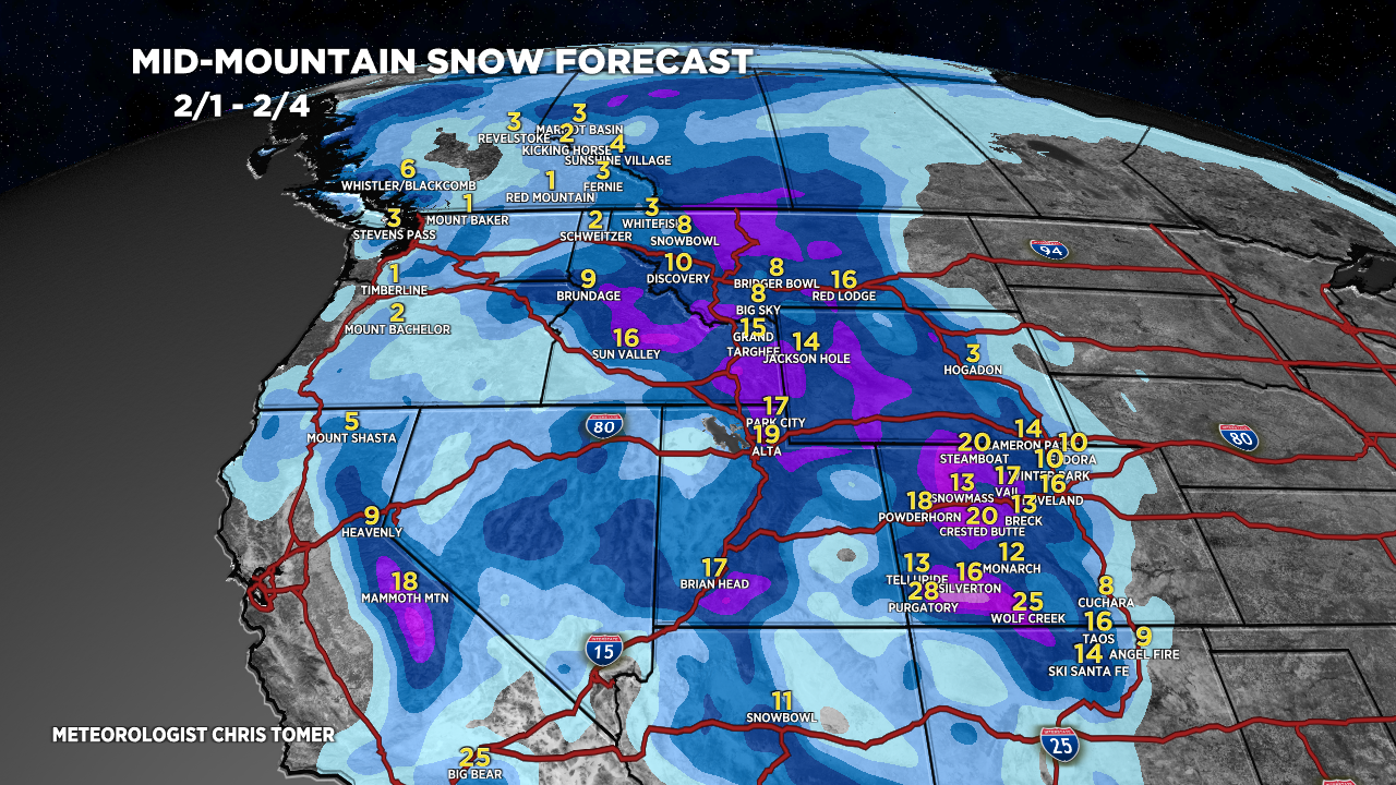
Tomer’s Take: Snow continues in Colorado and New Mexico 1/26 tapering-off this afternoon/tonight. Then a ridge of high pressure builds across UT/WY/CO/NM 1/27-1/31 with abnormally warm air temps and a higher freezing level. During this timeframe, a rich moisture flow hits the PNW/BC pushing freezing levels high. The first week of February looks active with a strong Subtropical jet stream and trough of low pressure.
My afternoon forecast video update:
Forecast Freezing Level
Revelstoke & Kicking Horse, BC (Min/Max):
1/26: 2800/3800′
1/27: 3400/5600′
1/28: 5100/6100′
1/29: 6400/7100′
1/30: 7200/8500′
Alta/Snowbird, UT (Max/Min):
1/26: 4300/5200′
1/27: 7500/8400′
1/28: 8900/9400′
1/29: 10300/11200′
1/30: 11500/11600′
Current Setup
Water vapor satellite shows a shifting pattern. The bulk of moisture will now be directed into the PNW/BC through 1/31.
Orange/red = drier air aloft.

Forecast Jet Stream
Ridge of high pressure UT/WY/CO/NM 1/27-1/31.

Pattern shifts and door swings wide open with rich moisture transport into the West.

Strong Subtropical jet stream transports areas of low pressure into the West.

Forecast Radar & Satellite
Forecast Totals


VT/NH/ME:
Rain/Snow 1/26, Snow 1/28-1/29, 2/1-2/2.
