Tomer’s Take: The next pattern shift continues to trend weaker on/after 11/13-11/18 for CA and the Interior Rockies. The main beneficiaries of heavy snow are ski areas in the PNW/BC. Optimism three to four days ago for heavy snow was predicated on a moderate to strong intensity atmospheric river (AR) contribution. That does not appear to be realistic now.
A few inches of new snow fell at Loveland, A-Basin, and Vail. Spectacular view from Vail this morning:

Current Setup
Infrared satellite shows a large trough of low pressure hitting AK, BC, and eventually the PNW.

Forecast Atmospheric River
Forecast ECMWF Integrated Vapor Transport (IVT) valid for the San Francisco lat/lon only favors weak AR contribution.

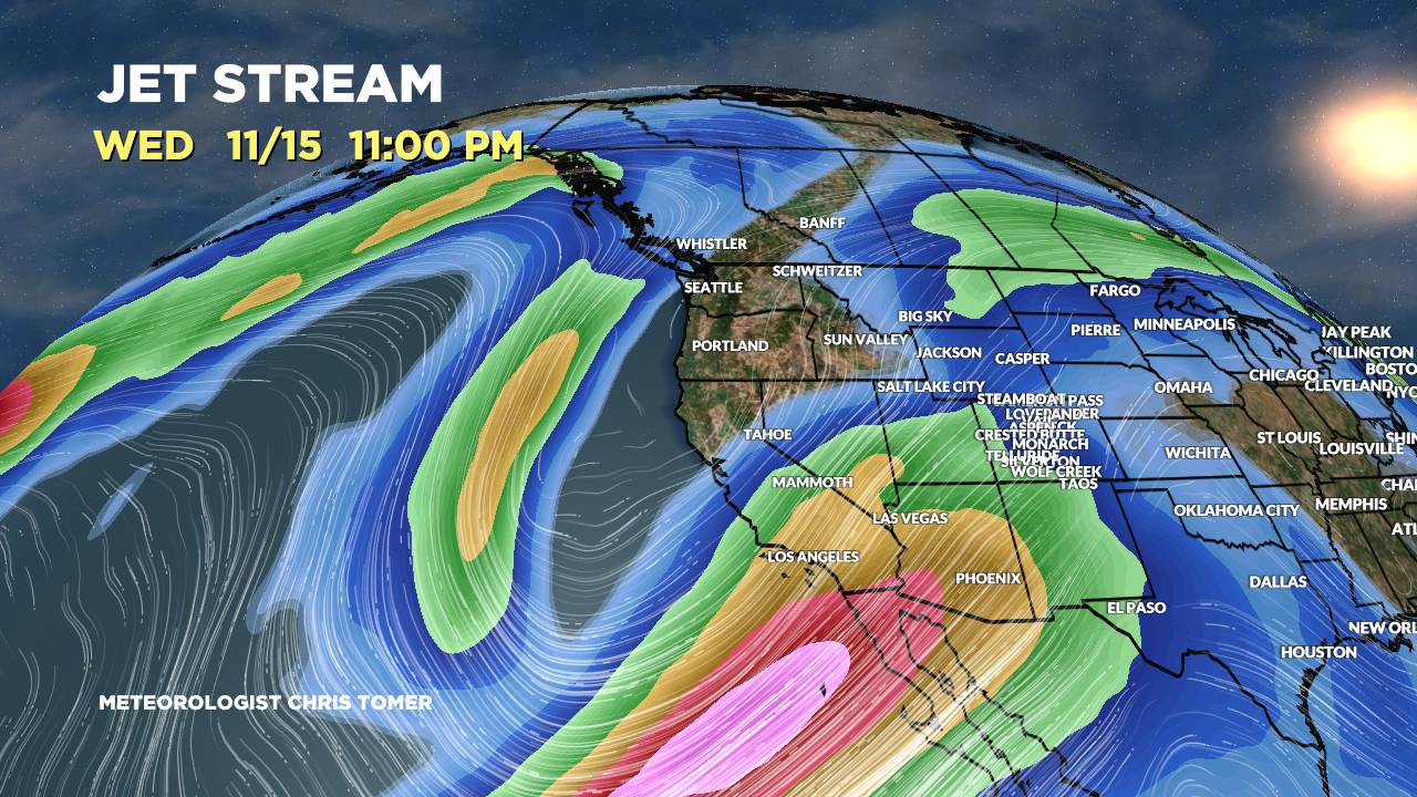
Forecast Jet Stream
Valid 11/15. A large trough of low pressure dives south from the PNW/BC towards the CA coast.

Valid 11/18. An area of low pressure exits through CO/NM. A powerful jet stream continues to favor the PNW/BC.

Forecast Radar & Satellite
Forecast Snowfall
*Update 2pm 11/9.
Valid 11/9-11/12. Heavy snow is likely in BC/PNW.

*Update 2pm 11/9.
Valid 11/13-11/17.
