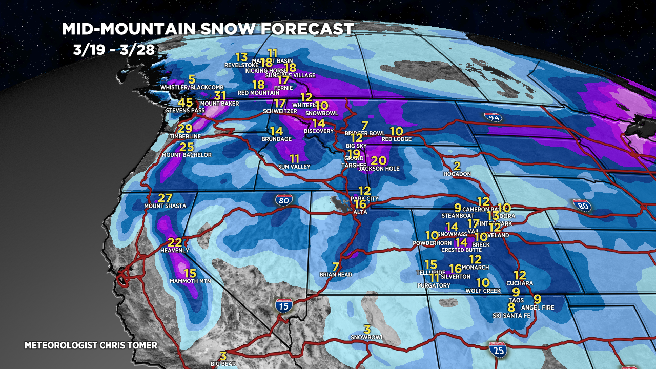
Tomer’s Take: A pattern shift occurs after 3/21 across most of the West. Two different storm systems are lined-up through 3/27 for the PNW/BC/MT/CA/ID/WY/UT/CO.
Timing
Pattern Shift After 3/21, Two Storm Systems.
Sierra: Heavy Accum PM 3/22-3/24.
Tetons: Light Accum 3/21, H 3/23-3/26.
Wasatch: Light Accum PM 3/21, H PM 3/22-3/26.
Colorado: Light Accum PM 3/21-3/22, H 3/23-3/26.
Banff Area: Heavy Accum 3/20-3/23.
Northeast: L Accum 3/19-3/20, M/H 3/23, 3/25.
My afternoon forecast video update:
Current Setup
Water vapor satellite shows the dying cut-off low over the 4-Corners.
Three different areas of low pressure are lined-up in the Pacific for the pattern shift after 3/21.
Orange/red = drier air aloft.

Forecast Radar & Satellite
Forecast Totals
Grand totals by late 3/28.


Northeast:
Bulk of accumulation occurs 3/23 & 3/25.
