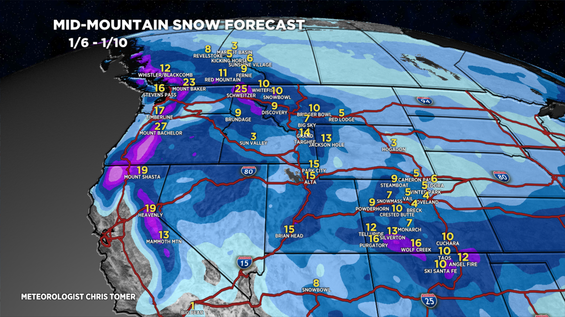
Tomer’s Take: The start of 2024 is mild but a large Western pattern shift is lurking 1/6-1/10. The Polar Jet buckles to the south from Canada and delivers colder air along with widespread snow for UT/WY/ID/CO/MT. California also has a few chances for snow in the Sierra. In the Northeast, we’ll have to watch the storm track on 1/7 closely as a large storm moves within striking distance of VT/NH/ME followed by another large storm system around 1/9-1/10.
My afternoon forecast video update:
Current Setup
Water vapor satellite shows a few different areas of low pressure stacked-up in the north Pacific. All three are players across the West. Low #1 hits CA with snow late 1/2-1/3 (above 7K) then takes a southern track with snow for AZ/NM/UT/CO on/about 1/4. This opens the door for the other storm systems and pattern shift.
Orange/red = drier air aloft.

Forecast Jet Stream
Valid 1/5. The Northern Branch buckles to the south escorting an area of low pressure into the PNW/BC. A 2nd storm system is riding its coattails.

Valid 1/10. Potential 3rd storm system digging south through Intermountain West.

Forecast Radar & Satellite
Forecast Totals

Southern track storm exits CA and delivers snow to UT/AZ/NM/CO on/about 1/4.


Northeast:
Closely watching storm track on 1/7 with a large storm system passing just south of VT/NH/ME. If it shifts north then heavy snow is possible. Another strong storm system is possible 1/9-1/10.
