Tomer’s Take:
- Today, a coastal low is spreading moderate snow to northern VT, northern NH, and northern ME.
- Significant lake effect snow near the Great Lakes will follow.
- A robust ridge of high pressure leaves the PNW/BC/CA high and dry through 11/20.
- Then a pattern shift is likely on/after 11/21.
- Jet pattern on/after 11/21 is strong but axis might favor northern tier of the Rockies.
Current Setup
Infrared satellite shows the storm track, high pressure ridge, and amplifying area of low pressure. Also notice the N-S fast moving cold front racing south from Banff into MT, WY, CO, northern NM.

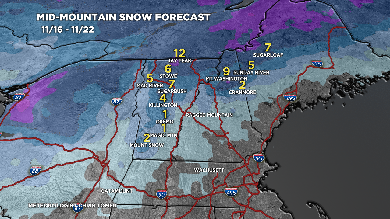
Northeast Snow
Forecast snow totals (inches) 11/16-11/22. Most of this falls today (11/16) with the coastal low.

Pattern Shift PNW
The current jet stream flow is dominated by high pressure over the PNW/BC and a fast N-S jet from Banff to MT to WY to CO.

Lower atmospheric pressures and a powerful jet stream move into the PNW/BC on/after 11/21. While this is great for the PNW/BC, it doesn’t favor the southern tier of the Rockies given the northern axis of the jet.

Forecast Timing
Forecast radar/satellite valid 11/16-11/21.
Forecast Snowfall
Forecast snow totals (inches) valid 11/16-11/18.

Forecast snow totals (inches) valid 11/19-11/24.
