Tomer’s Take: Storm cycle continues until 2/10. CA’s big storm system is finally making its move into the Intermountain West. Snowfall increases in UT and CO afternoon 2/6-2/9, snow continues in WY 2/6-2/9. A smaller, weaker storm system races through PNW/BC/Northern Tier 2/11-2/12 with light snow accumulation. Drier pattern 2/13-2/17.
My afternoon forecast video update:
Current Setup
Water vapor shows the large CA storm system finally making its move into the Intermountain West.
Orange/red = drier air aloft.

Forecast Jet Stream
Broad trough and storm system moving through Intermountain West. Two smaller pieces of energy get absorbed keeping the snow going through 2/9.

Trough and storm system moving through UT/CO/WY/NM and then exiting 2/10.

Forecast Radar & Satellite
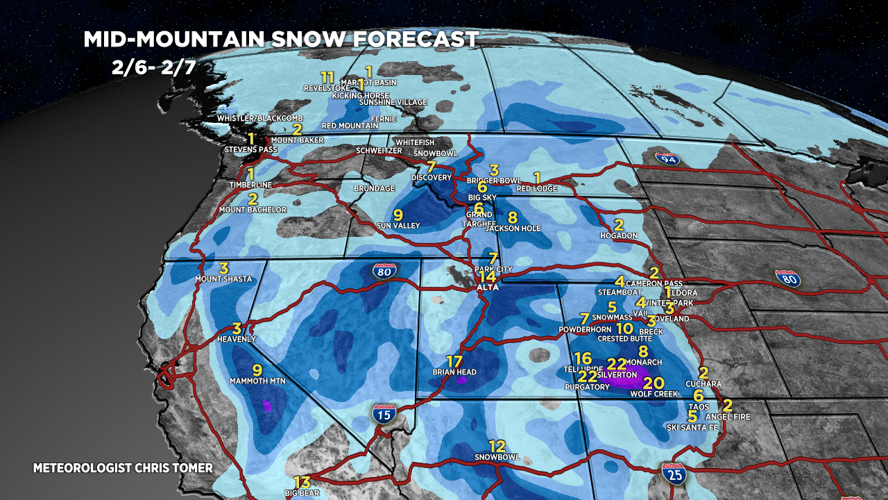
Forecast Totals


