Tomer’s Take: The next storm system is already spreading moderate snow over southern ID and it rolls into the Tetons this afternoon through the morning of 3/6 with heavy snow accumulation. This frontal boundary slides across the Wasatch on 3/7 with moderate snow accumulation. The storm system strengthens in CO/NM on 3/8-3/9 with enhanced accumulation. Then the pattern shifts north to favor the PNW/BC/Northern Tier 3/10-3/12 before diving south into UT/WY/CO 3/13-3/14.
Timing
*Updated 4pm 3/5/2024.
Heavy Teton snow now through 3/6, heavy 3/11-3/13.
Storm System 3/5-3/8.
Wasatch Light Snow 3/6, 4-8″ 3/7, H 3/12-3/13.
Colorado Light Snow 3/6, M 3/7-3/8.
Northeast Heavy Rain PM 3/6-3/7, Snow 3/10-3/11.
My afternoon forecast video update:
Current Setup
Water vapor satellite shows the next storm system now moving into Northern CA and OR spreading moderate heavy snow into ID and eventually WY.
Orange/red = drier air aloft.

7:30am Radar:

Forecast Radar & Satellite
Forecast Totals
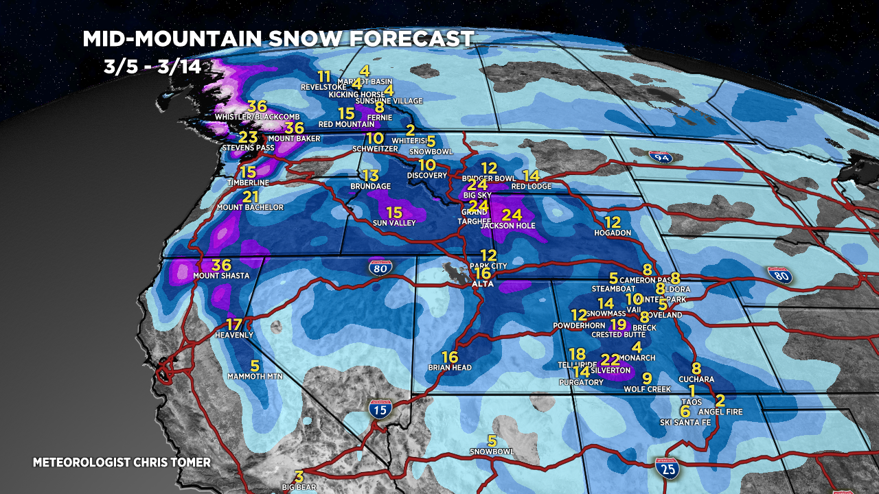
Forecast Grand Totals by late 3/14.


Northeast:
VT/NH/ME rain 3/5 & PM 3/6. Snow 3/10-3/11.
