Tomer’s Take: A more active Western storm track develops after 12/20 and runs through Christmas and especially New Years. In California, the rain/snow line today drops to 8,000′-8,500′ with heavy snow accumulation above that level. On 12/23-12/24, two pieces of energy merge over Colorado/Wyoming to deliver moderate to heavy snow accumulation. There is a trend now for a weaker energy merger.
My afternoon/evening forecast video:
Current Setup
Water vapor satellite shows two areas of low pressure over the Pacific. The first low drops south and takes a southern track. The 2nd low hits the PNW then moves through WY/UT/WY. Both pieces of energy merge over WY/CO/NM 12/23-12/24.
Orange/red = drier air aloft.

Forecast Jet Stream
Valid 12/24. Trough over WY/UT/CO escorts a storm system with moderate to heavy snow accumulation.

Valid 12/28. Powerful jet stream and large trough translating over the Pacific. This could represent more active and colder pattern around New Years into January 2024.

Forecast Radar & Satellite
Christmas Forecast
Valid 1pm 12/24. Low strengthens and slides from UT through WY & CO.

Valid 4:30am 12/24. Low exits WY/CO and snow decreases.

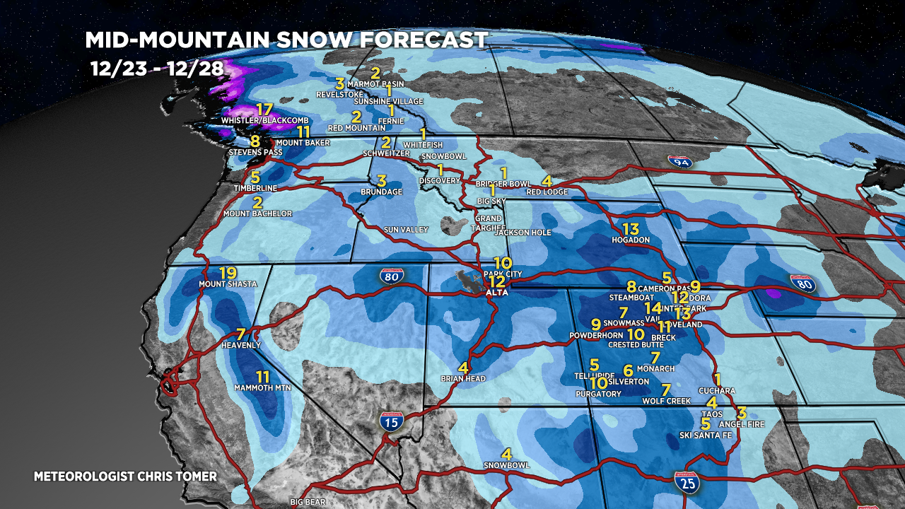
Forecast Totals
*Updated 2pm 12/19.

*Updated 2pm 12/19.
UT Snow: Late 12/22-12/24.
WY Snow: Late 12/23-12/24.
CO Snow: 12/23-12/24
NM Snow: 12/23-12/24.

*Updated 2pm 12/19.
99% of accumulation: 12/26-12/28.
