Tomer’s Take:
- The next Monsoon surge occurs over the Mountains between Friday afternoon and Monday morning.
- The bulk of the precipitation occurs over the Southern Mountains with less impact as you go North.
- Overall, this is a moderate surge. Not as big as last week. Primary impact is for higher chances of midday/afternoon/evening rain and thunderstorms.
- It means smaller recreation windows but most mornings should be dry.
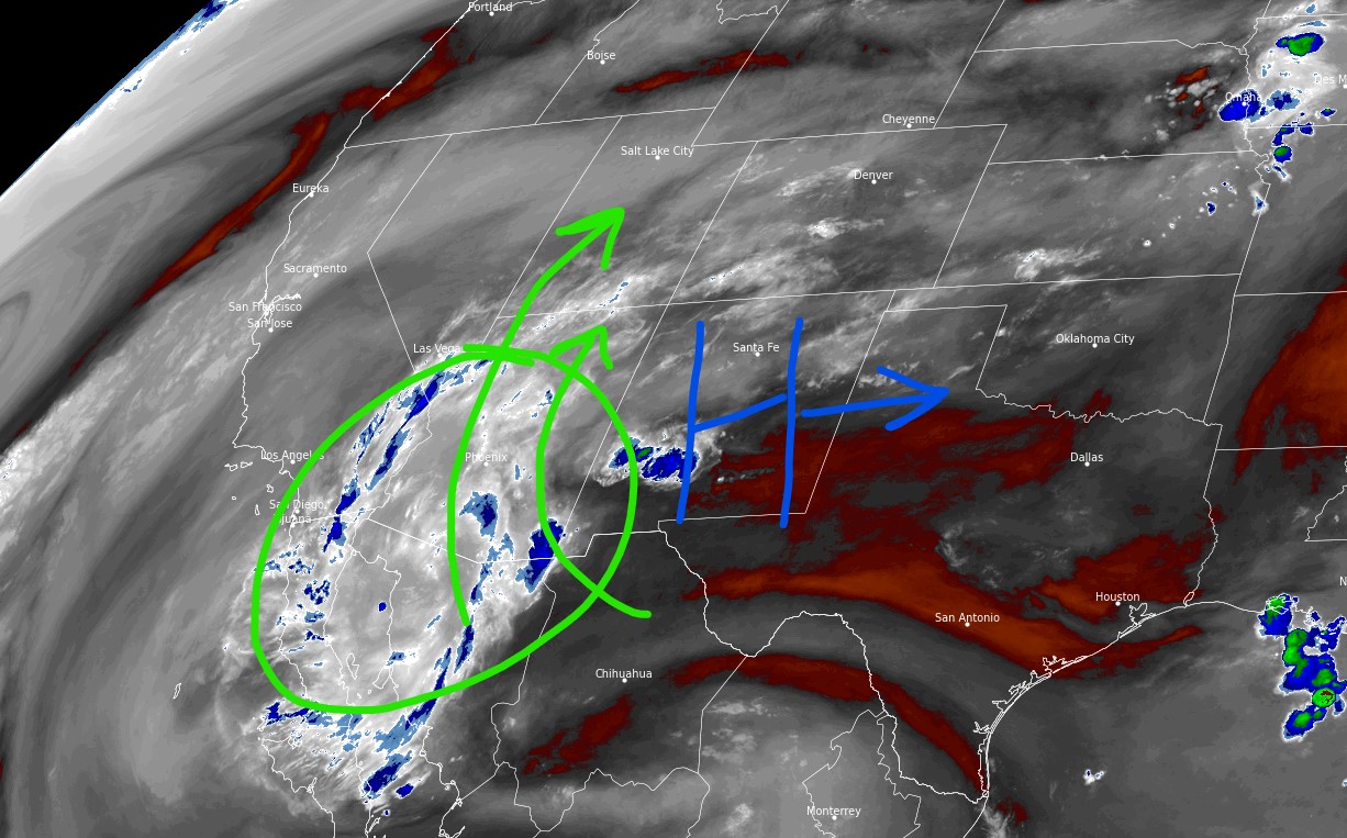
Current Setup
It’s beautiful morning Telluride. This illustrates how weather normalizes in between Monsoon surges.

The bulk of Monsoon moisture is currently to the Southwest of Colorado. The key high pressure is sitting just south of Colorado in New Mexico. By this weekend, the high pressure moves east and opens the door for the surge.

By the weekend, the door is wide open and precipitable water values are above 100%.

Forecast
| Mount Eolus | AM | PM |
| 8/5 | Dry | 100% |
| 8/6 | Dry | 100% |
| 8/7 | Dry | 100% |
NWS digital point forecast for 13,000ft Central Mountains near Twin Lakes/Mount Elbert valid 8/5-8/6.

Utah friend here, looks like we’re going to get a good amount here too. Thanks for all the great info Chris.
Thanks, Alex! Chris