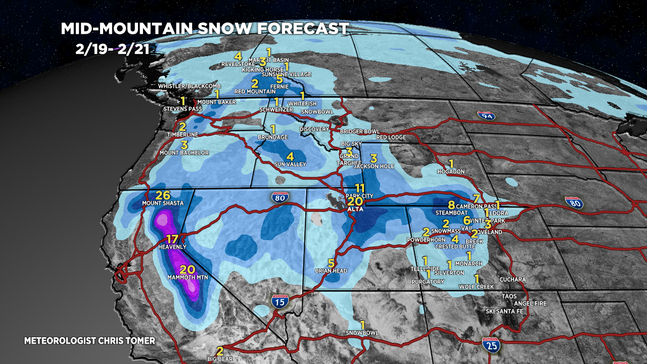
Tomer’s Take: Moderate snow accumulation hits Tahoe & Mammoth tonight into early 2/18. A wave of light snow accumulation overspreads UT/WY/CO on 2/18. A major storm system delivers 1-2 feet of accumulation in the Sierra 2/19-2/20. This same storm system then hits the Wasatch with 1-2 feet (or more) 2/19-2/21, and Colorado’s Central & Northern Mountain Zones with 6-12 inches 2/21-2/22.
On/after 2/25 the Northern Branch gets involved and significant snow is possible.
My afternoon forecast video update:
Current Setup
Water vapor satellite shows three different areas of low pressure. The 2nd storm system is associated with the primary trough in the atmosphere. This is the 2/19-2/22 storm system.
Orange/red = drier air aloft.

Forecast Jet Stream
Forecast Radar & Satellite
Forecast Totals


2/25-2/28: Dynamic period with Northern Branch involvement. Significant snow is likely with this setup and colder air.


Thank you from Vail !
Thanks, Greg!