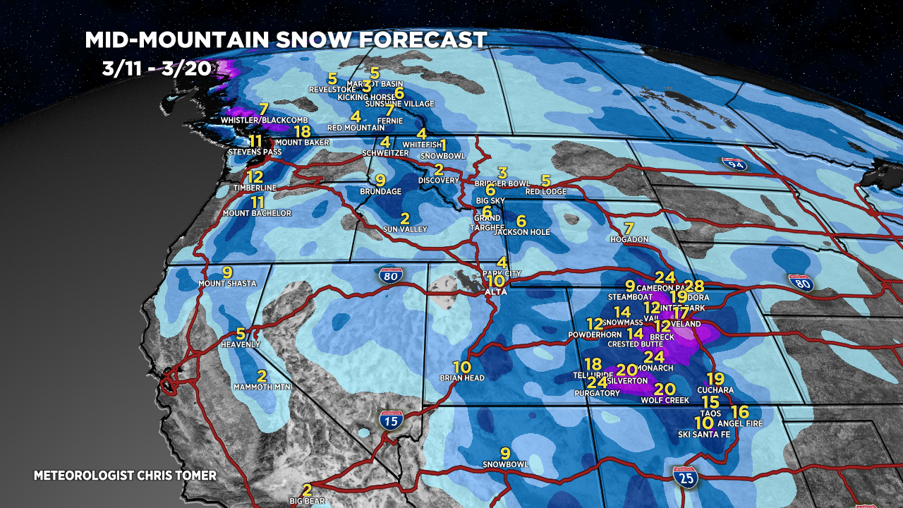
Tomer’s Take: A major Colorado storm system spins up 3/13-3/14 maximizing orographics. Many ski areas could see 1-2 feet of accumulation.
Timing
*Updated 6pm 3/11/2024.
Colorado Low Spins Up 3/13-3/15, totals down slightly.
Colorado: Light Accum Tonight-3/12, H 3/13-3/14, L 3/15.
Tetons: Light Accum Tonight, M 3/12-3/13.
Wasatch: Light Accum Tonight, M 3/12-3/13.
New Mexico: Moderate Accum 3/13-3/15, H 3/16.
Northeast: R/S 3/16, Snow 3/19.
My afternoon forecast video update:
Current Setup
Water vapor satellite shows a small pre-storm system 3/11 then a major area of low pressure riding the Northern Jet into the PNW/BC. This is the storm system that dives south into UT/WY/CO/NM 3/12-3/15.
Red/orange = drier air aloft.

Forecast Radar & Satellite
Forecast Totals
Grand totals by late 3/20.


Northeast:
VT/NH/ME: Light snow accumulation 3/11. Rain to snow 3/15-3/16.
