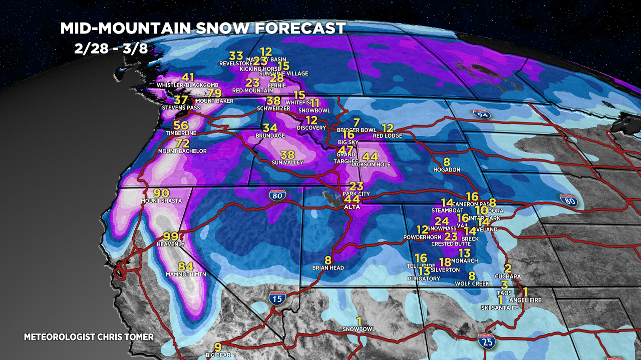
Tomer’s Take: A major storm system delivers feet of accumulation to PNW/BC/CA/ID/WY/UT/CO 2/29-3/4. Additional storm systems race across the Rockies 3/5-3/8 with an active jet.
Timing
*Updated 5pm 2/28/2024.
Wasatch PM 3/1, 3/2 – AM 3/4, 3/7-3/8.
Tetons Late 2/29-3/7.
Colorado Late 3/2-3/4, 3/6-3/8.
Sierra 4-8 Feet PM 2/29-3/3 (>5K).
Powder Highway, Canada 1-2FT Now-3/2, 3/8 (Totals down 20-30%).
My afternoon forecast video update:
Current Setup
Water vapor satellite shows the next storm system sliding south with a buckling northern jet branch.
Orange/red = drier air aloft.

Forecast Radar & Satellite
Forecast Totals
Grand Totals by late 3/8.


My brother loves you!
Thanks, Stacy!