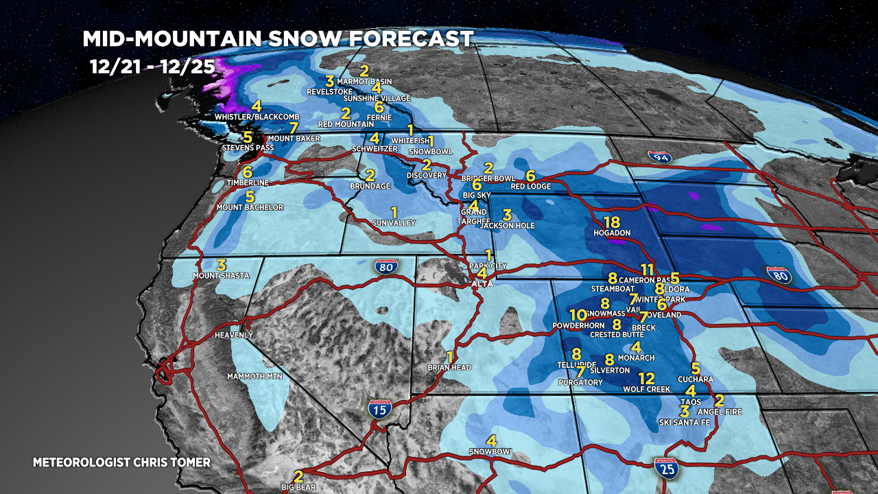
Tomer’s Take: Calendar Winter (Winter Solstice) officially arrives today. Two pieces of energy merge over WY/CO 12/23-12/24. The merger timing is slower and final low not as deep resulting in lower totals for the Wasatch and Tetons. Heavier totals in southern WY and parts of CO.
Looking down the road, a rich flow and strong jet stream hits California 12/27-12/30 with heavy snow potential.
My afternoon forecast video update:
Current Setup
Water vapor satellite shows both areas of energy and ultimate merger zone over WY/CO.
Orange/red = drier air aloft.

Forecast Jet Stream
Notice the trough over WY/CO. It’s not as deep as previous forecasts.

Active, powerful jet pattern ushering rich moisture into CA/West Coast.

Forecast Radar & Satellite
Forecast Totals
*Updated 2:15pm 12/21.
CO Snow: 12/23-12/24.
WY Snow: 12/23-12/24.
UT Snow: 12/23.

*Updated 2:15pm 12/21.
CA Snow: 12/27-12/30.

*Updated 2:15pm 12/21.
NY/VT/NH/ME Precip: 12/27-12/30. Rain initially then changing to snow.

Thank you Chris!
We need the snow in Summit County. Hoping for a nice Christmas present!
Thanks, Paul! Have a great Christmas. Chris