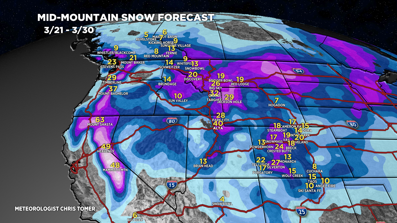
Tomer’s Take: Now I’m seeing four different storm systems through 3/30. This means feet of grand total accumulation for PNW/MT/ID/CA/WY/UT/CO.
Timing
*Updated 4:15pm 3/21/2024.
Four Storm Systems Through 3/30.
Sierra: H Accum PM 3/22-3/24, H 3/27, H 3/29-3/30.
Tetons: L Accum 3/21, M/H 3/23-3/25, L 3/26, H 3/28.
Wasatch: L Accum PM 3/21, H 3/23, L 3/24-3/26, H 3/28, H 3/30.
Colorado: L Accum Late 3/21, H 3/23-3/25, M 3/26, H 3/28-3/30.
Northeast: Heavy Accum 3/23, H 3/27-3/29.
My afternoon forecast video update:
Current Setup
Water vapor satellite shows all four storm systems lined-up. The first storm system fights high pressure and disintegrates but lays the groundwork for the remaining three storm systems to arrive full-force.
Orange/red = drier air aloft.

Forecast Radar & Satellite
Forecast Totals
Grand totals by late 3/30.


Northeast:
Heavy snow accumulation 3/23, moderate 3/27-3/28.

Pretty exciting forecast, especially when we have all next week to hit some of these areas. Nice way to approach the end of the season.
Yes! Thanks, Tim. Chris