Tomer’s Take: The main trough of low pressure hitting CA breaks loose tonight and slides through UT/CO 2/21-2/22. The pattern shifts on/after 2/25 when the Northern Jet Branch buckles south and merges with the Subtropical Jet. Big totals likely.
Timing
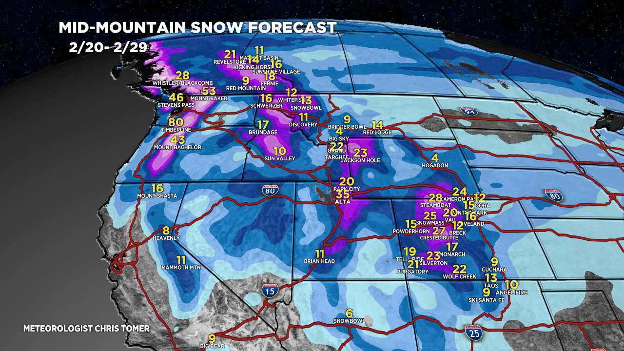
*4:30PM 2/20 Update.
CA 3-6″ Tonight – AM 2/21.
Wasatch 8-16″ Next 24 Hours.
Tetons 1-2″ 2/22.
Colorado 1-4″ Next 48 Hours.
Northern Branch Merger 2/25-2/29, WNW Flow.
Northeast Light/Moderate Snow 2/23, 2/27-2/28.
My afternoon forecast video update:
Current Setup
Water vapor satellite shows the large trough of low pressure hitting CA then breaking loose and moving through UT/CO 2/21-2/22.
The second area of low pressure in the Gulf of Alaska sends a small piece of energy south into CA while the main trough slides into AK/Canada then south into the United States with a buckling Northern Branch.
Orange/red = drier air aloft.

Forecast Jet Stream
Forecast Radar & Satellite
Forecast Totals
Grand totals by late 2/29.


