Tomer’s Take: Both jet streams become active and deliver moisture 11/30-12/5. Plus, the northern branch appears to setup a WNW Flow pattern with big snow accumulation in PNW, BC, ID, WY, UT, and CO. The rich flow in the PNW is associated with a moderate to strong intensity atmospheric river (AR).
My Afternoon forecast video update:
Current Setup
Water vapor satellite shows both jets escorting storm systems.
Orange/red = drier air aloft.

Forecast Jet Stream
Valid 12/2. WNW Flow down to 10k delivers with efficiency.

Valid 12/8. Storm system slides into PNW then interior Rockies.

PNW Atmospheric River
Forecast Integrated Vapor Transport (IVT) for WA/OR coast at 46N/124W. A moderate to strong atmospheric river intensity is likely.

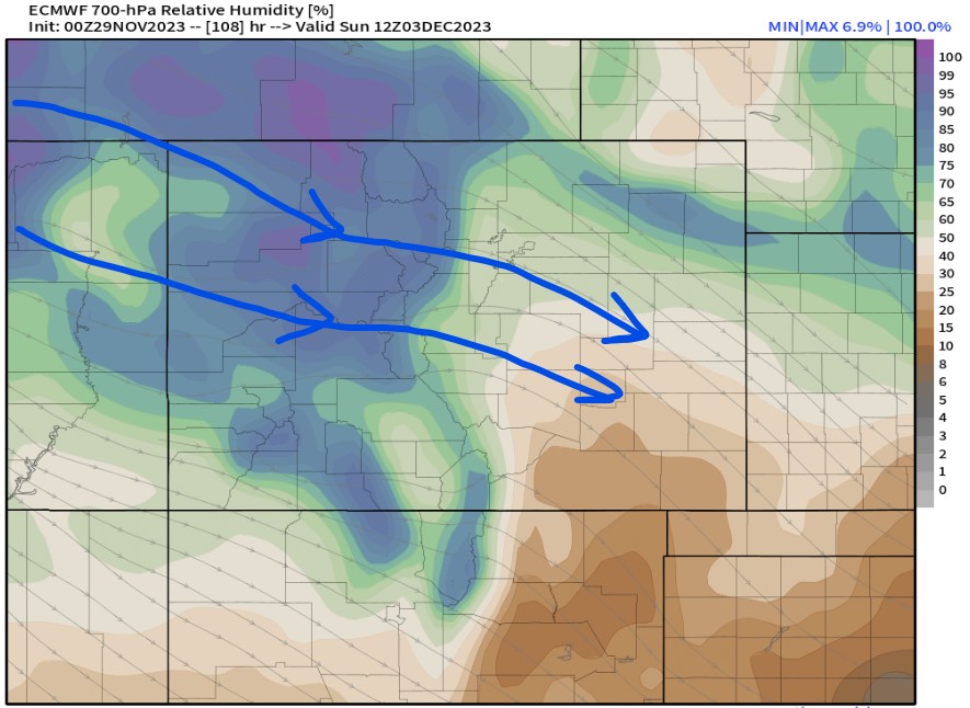
WNW Flow Pattern
Valid 12/3. Forecast 10,000ft flow shows the WNW orientation.

Valid 12/3. Forecast 10,000ft moisture (RH%) and streamlines. An efficient flow for the Central and Northern Mountain zones.

Forecast Radar & Satellite
Forecast Snow Totals
*Updated 230pm 11/29: Flow not as strong in CO, cut forecast totals by about 30%
Snow Timeline Cheat Sheet ->
PNW: PM 11/30-12/5, 12/7-12/8
ID: 12/1-12/7
WY: 12/1-12/4, 12/8.
UT: 12/1-12/4, 12/8.
CO: PM 11/30-12/4, 12/8-12/10.

*Updated 230pm 11/29.

*Updated 230pm 11/29.
