Tomer’s Take: Feet of total accumulation is still on track for PNW/BC/CA/ID/UT/WY/CO through 3/9. The first major storm system is currently dropping south from the PNW/BC into CA and eventually the interior Rockies 3/1-3/4. 50-80mph ridgeline wind gusts likely CO/UT/WY. Blizzard Warnings are in place for the Sierra and 4-8 feet of total accumulation. Additional small to medium sized storm systems are likely 3/5-3/9.
Timing
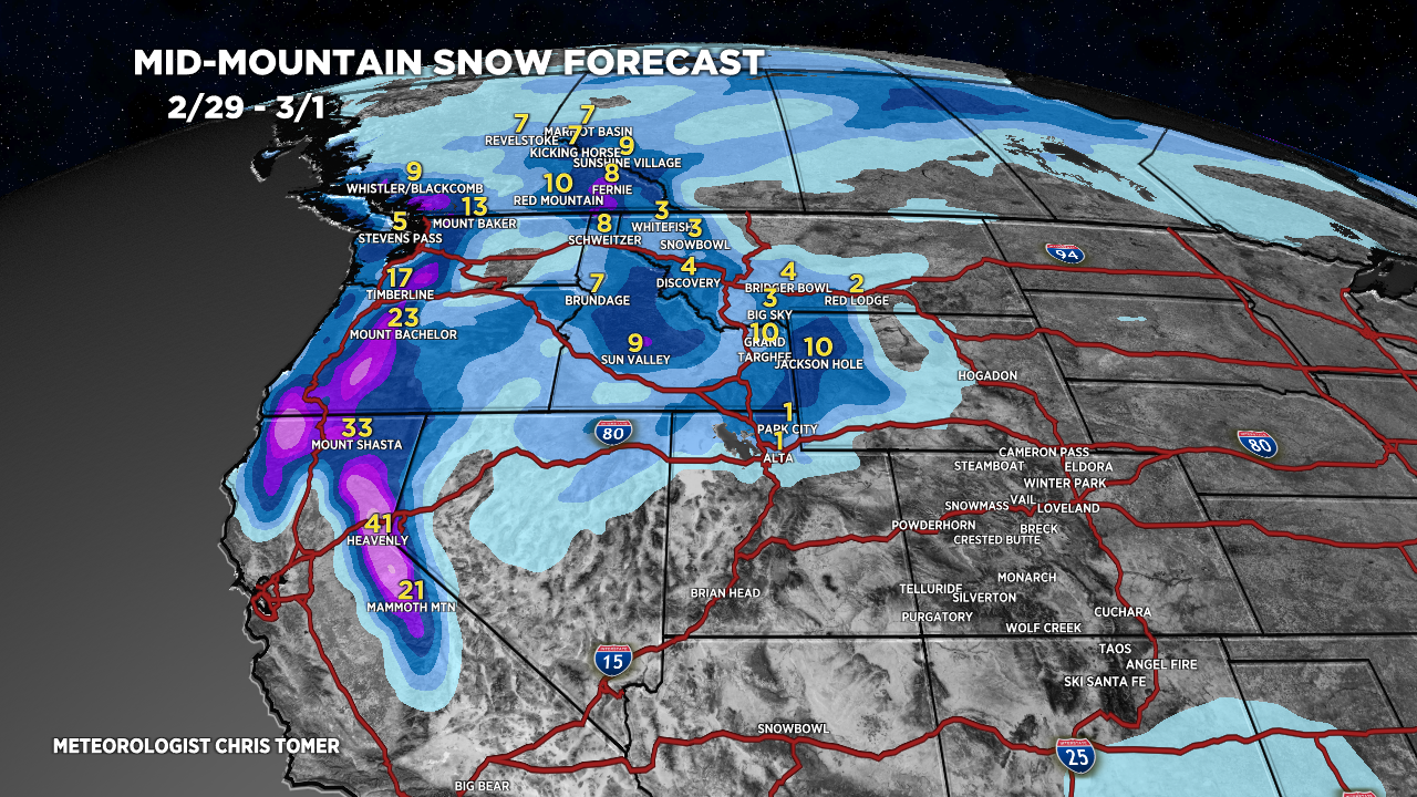
*Updated 4pm 2/29/2024.
Wasatch Light Snow PM 3/1, Heavy PM 3/2, Light 3/3.
Tetons Light Snow Tonight, Heavy 3/1-3/2, Light 3/3, Moderate 3/4-3/5. Colorado Heavy Snow Late 3/2-3/3, Light 3/4.
Sierra 4-8 Feet Now – AM 3/3 above 5,000ft.
Powder Highway, Canada 6-14″ Now-3/4.
My afternoon forecast video update:
Current Setup
Water vapor satellite shows storm #1 dropping south from PNW/BC with a CA trajectory and eventually interior Rockies.
Orange/red = drier air aloft.

Forecast Radar & Satellite
Forecast Totals


Thank you Chris!
Coffee and snow for breakfast!
Enjoy, Paul! Thanks!