Tomer’s Take: The jet stream shifts north favoring the PNW through 11/6, and it’ll reach far west into the Pacific setting up a ‘weak to moderate intensity’ atmospheric river (AR). Snow levels will start high. This pattern also favors the higher elevations of BC and Banff for snowfall.
Aerial of Crested Butte Mountain taken today after two feet of new snow last 72 hours! Snowmaking has started a few days early. Opening day is November 22. Photo: Taylor Ahearn.

My forecast video:
Current Setup
Water vapor satellite shows a reorganizing pattern and powerful Pacific jet stream loaded with energy.
Red/orange = drier air aloft.

Forecast Atmospheric River
Below is forecast Integrated Vapor Transport (IVT) valid 11/1 – 11/2. Deep moisture transport from the Pacific/Hawaii.

Below is model forecast IVT for the PNW. There are two ‘weak to moderate’ intensity AR surges.

Forecast Rain/Snow Line
Washington State (Min/Max):
11/1: 8200/10500
11/2: 7900/10000
11/3: 6600/9800
11/4: 7400/8700
Idaho:
11/1: 8700/9700
11/2: 9800/10500
11/3: 8700/9500
11/4: 9200/9500
Forecast Jet Stream
Valid 11/1. Jet favors PNW/BC/Banff.

Valid 11/2. Wider view shows the jet stretching far West into the Pacific.

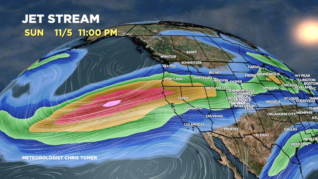
Valid 11/5. Powerful jet stream orientation. This pattern shifts snowfall further south into the Intermountain West.

Forecast Radar & Satellite
Forecast Snowfall
*Update 4pm 10/30.
Valid 10/30-11/5. Initially, high snow levels limit snowfall in the PNW/BC. Then, as colder air filters in, snow levels gradually drop. Rainier should get at least two feet.

*Update 4pm 10/30.
Valid 11/6-11/8.

Beauty of a photo there Taylor. Thanks for posting that!
You bet, Randall!