Tomer’s Take: I’m tracking a large CA trough of low pressure and two cold fronts coming out of the PNW. The interaction should generate snow for PNW, BC, Banff, MT, ID, WY, UT, CO, and NM.
My forecast video:
Current Setup
Water vapor satellite shows the large CA trough. It really dictates the near future.

Forecast Jet Stream
Valid 11/19. Powerful and amplified jet stream. The bulk of energy drops north to south through MT, WY, UT, CO, NM. Look for low pressure development in eastern Colorado.

Valid 11/23. A cold front is dropping north to south from Canada through MT, WY, and eventually CO.

Forecast Radar & Satellite
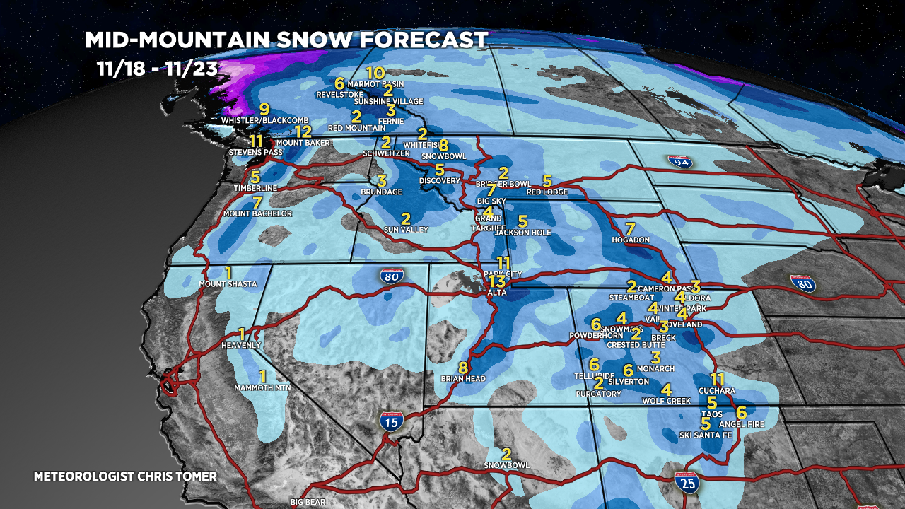
Forecast Snowfall
*Updated 3pm 11/14.
Valid 11/14-11/17. The snow in UT and CO occurs on the 11/16.

*Updated 3pm 11/14.
Valid 11/18-11/23. UT snow occurs 11/18-11/19, and CO snow occurs 11/19-11/20.
