Tomer’s Take: Three different storm systems loaded with Atmospheric River (AR) moisture hit the PNW/BC through 11/10 with overrunning snow in Banff, MT, and WY. The Tetons are in good position for heavy snow accumulation.
My forecast video:
Current Setup
Water vapor satellite shows all three areas of low pressure lined up.

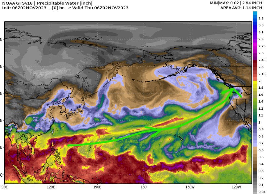
Atmospheric River
Forecast atmospheric precipitable water shows a dragon’s breath of moisture stretching all the way back past Hawaii. This is the River.

Forecast Jet Stream
A powerful west to east oriented jet acts like a conveyor belt for moisture transport.

Forecast Rain/Snow Line
Teton Range, WY (Min/Max):
11/2: 7400/9500
11/3: 7900/8700
11/4: 8200/9400
11/5: 5900/8700
11/6: 5100/7700
11/7: 4400/6600
Forecast Radar & Satellite
Forecast Snowfall


Forecast Snow Timeline
Teton Range, WY:
11/2: PM 7″
11/3: AM 4″
11/4: PM 2″
11/5: 3″
11/6: 2″
11/7: 4″
11/8: 1″
Thank you Chris! What is next week looking like from Steamboat to Vail area.
Hi Vickie – It looks dry until Tuesday-Wednesday (11/7-11/8) when a cold front and snow race through. Chris