Tomer’s Take: Two weak to moderate intensity atmospheric river (AR) surges hits the PNW/BC between 11/2-11/8 with overrunning snow in Banff, MT and especially WY where a snow bullseye is possible. Snow levels start high in the PNW/BC with snow at higher elevations.
My forecast video:
Current Setup
Water vapor satellite shows a powerful Pacific Jet and area of low pressure aiming at the PNW/BC.
Red/orange = drier air aloft.

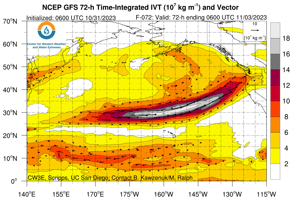
Forecast Atmospheric River
Moisture transport: Forecast Integrated Vapor Transport (IVT) valid 11/2-11/3. Notice it’s pointed into the PNW.

Forecast IVT for PNW showing two different weak to moderate intensity surges.

Forecast Jet Stream
Valid 11/2. Jet acts like a moisture conveyor belt.

Valid 11/5. Powerful jet stream orientation.

Forecast Snowfall
*Updated 4pm 10/31.
Valid 10/31-11/5. The bullseye is the Teton Range.

*Updated 4pm 10/31.
Valid 11/6-11/9.

Specific Forecasts
Jackson Hole Ski Area (mid-mountain or higher):
11/2: PM 2-3″
11/3: AM 4-6″
11/4: 6″
11/5: 6″
11/6: 1-3″
11/7: 1-3″
Mount Rainier:
11/1: PM 7″
11/2: 16″
11/4: 15″
11/5: 8″
11/6: 6″
11/7: 6″
Forecast Rain/Snow Line
Washington State (Min/Max):
11/1: 8700/11300
11/2: 6900/9200
11/3: 6900/8900
11/4: 6400/8500
11/5: 6200/7200