Tomer’s Take: Two cold fronts deliver snow (10/24-10/29) and the coldest air of the season so far.
Colorado stays abnormally warm until late 10/27 then temps drop quickly. Below zero mountain temps likely on the morning of 10/30.
My forecast video:
Snow continues at Lake Louise Ski Resort, Banff.


Timeline
10/24-10/26: Cold front, Banff, PNW, Northern CA, ID, WY, MT, UT, CO.
10/27-10/29: Cold front, UT, WY, CO.
Current Setup
Water vapor satellite shows a big low in the Pacific anchoring the pattern.
Red/orange = drier air aloft.

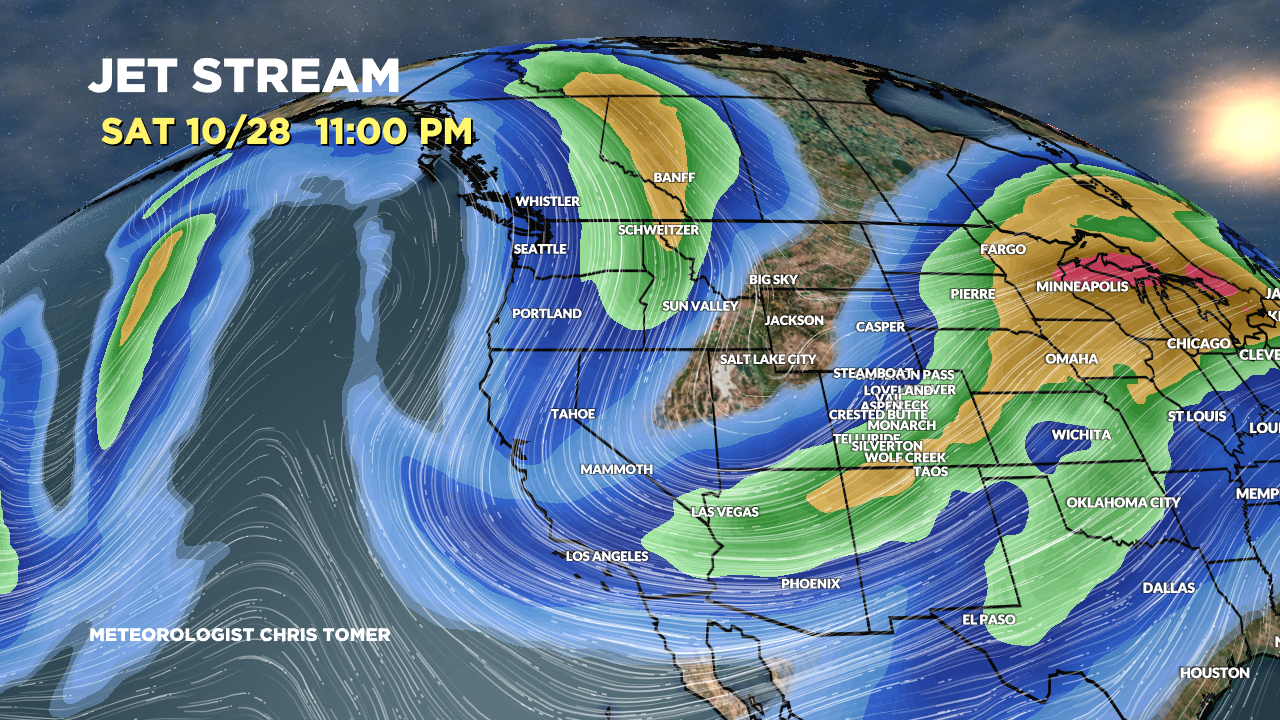
Forecast Jet Stream
Forecast jet stream valid 10/28. Notice the big trough over the Intermountain West. This unlocks the coldest air of the season so far.

Forecast Rain/Snow Line
Wasatch Range, UT, (Min/Max Level):
10/24: 10500/11600
10/25: 10800/12100
10/26: 4400/9500
10/27: 5700/8400
10/28: 4300/6400
10/29: 4100/7100
Teton Range, WY:
10/24: 10500/11600
10/25: 10800/12100
10/26: 4400/9500
10/27: 5700/8400
10/28: 4300/6400
10/29: 4100/7100
Central Mountains, CO:
10/24: 11000/13800
10/25: 11000/14300
10/26: 10500/13800
10/27: 11000/13000
10/28: 6600/9500
10/29: 2500/7700
Forecast Radar & Satellite
Forecast Snowfall
(*Updated 2pm 10/24)
10/24-10/27:

(*Updated 2pm 10/24)
10/28-10/29:
