Tomer’s Take
- The storm track shifts south on/after 3/4 from the PNW/B.C. into MT, WY, UT, ID, CO, NM.
- This sets up a 9-day window with 3 different storm systems and major snow grand totals.
- The first two storm systems are back-to-back 3/4-3/7. The 3rd storm system arrives 3/9-3/10.
- The first storm system on 3/4-3/5 is the warmest of the three.
- The Northeast can expect a few different storm systems. The initial storm system on 3/6 is warm but the final two storm systems next week look colder with heavier snow potential.
Infrared satellite shows the dipping jet stream building across the West. This will set the stage for 3 different storm systems across the Intermountain West over the next 9 days. The southern jet branch might also contribute.

3rd Storm System
The final storm system of this cycle hits the Intermountain West between 3/9-3/10. Below, notice the forecast pressure anomalies across the West suggesting cold and snow.

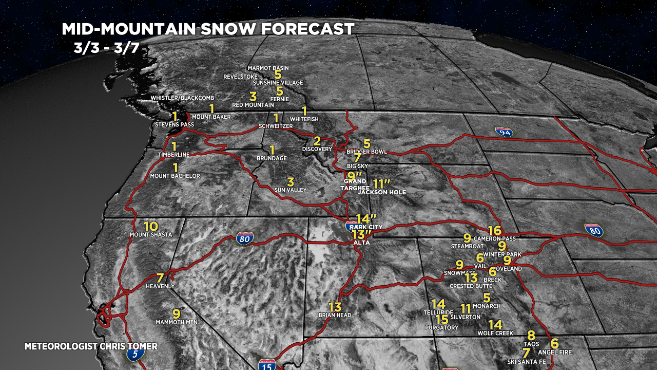
Snow Forecast
3/3-3/7:

3/8-3/12:

Northeast, 3/3-3/12:

For more analysis please watch my forecast video:
Checking in here, hoping others do as well. Opensnow just killed the comment section :-(. You rock Chris!!!
Thanks, Craig! Chris