Tomer’s Take:
- A large trough and powerful jet stream control the West through 5/15 then might break.
- The jet stream paints the West with strong winds through 5/15. High wildfire danger.
- The main storm track runs through northern CA, PNW, northern UT, ID, MT, and WY. This leaves southern UT, CO, NM, AZ on the drier and windy side of the jet stream.
- The Spring Melt is kicking into high gear. The various dust layers are likely accelerating the melt.
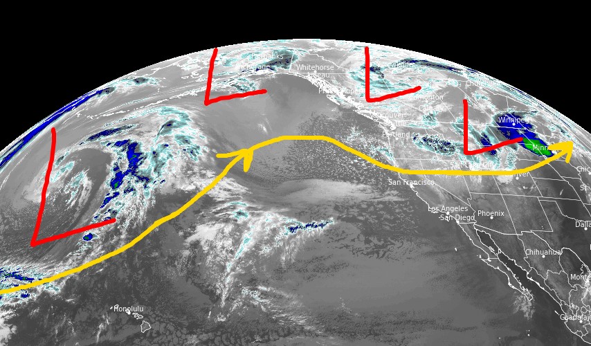
Infrared satellite shows the storm track. This pattern leaves southern UT, CO, AZ, and NM on the drier and windy side of the jet stream.

Take a look at Snowbird, UT this morning where 12″ of new snow is reported:

Wind Gust Forecast
| Forecast (MPH) | 5/9 | 5/10 | 5/11 | 5/12 |
| Crestone Needle | 80 | 60 | 65 | 65 |
| Quandary Peak | 60 | 40 | 40 | 50 |
| Mount Sneffels | 70 | 55 | 55 | 45 |
| Humphreys Peak | 70 | 55 | 55 | 65 |
| Wheeler Peak | 65 | 45 | 50 | 45 |
| Kings Peak | 45 | 60 | 55 | 30 |
| Mount Whitney | 75 | 55 | 35 | 25 |
Beyond 5/15
The pattern might shift after 5/15 with higher pressures replacing the big Western trough.
Below, notice the higher pressure anomalies building across the West on 5/16.

Dirty Snowpack
Significant amounts of dust (possibly the most since 2009) were deposited on the snowpack across UT and CO. Here’s the view at Wolf Creek ski area this morning. Snow is dirty and melting quickly. It was a 385-inch season at Wolf Creek.

Snow Forecast
5/9-5/18:

Thanks Chris!