Tomer’s Take: Smoke from wildfires in Canada is moving south into the United States and may affect the Intermountain West air quality through this weekend. And, record rainfall 5/10-5/12 wiped out the drought in Denver. Plus, the afternoon thunderstorm pattern is in full swing along with a surge of moisture on 5/18 and early 5/19 with heavy rain potential. Finally, freezing levels stay high accelerating the Western snowpack snowmelt.
Wildfire Smoke
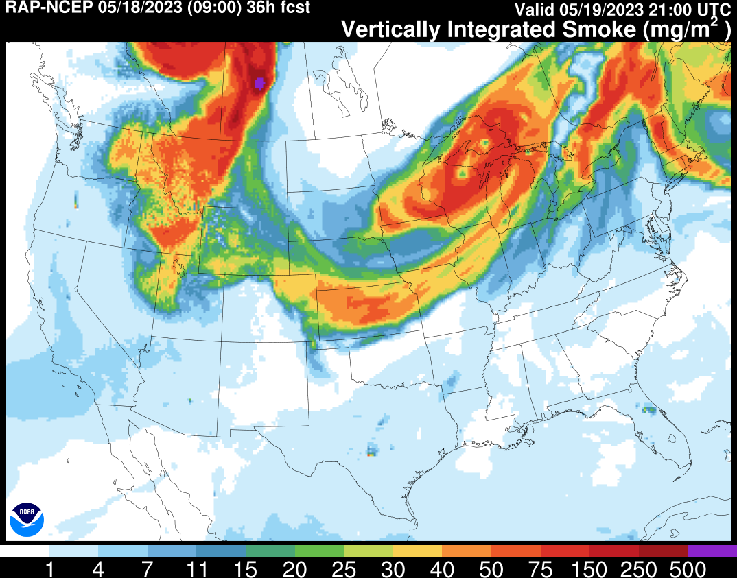
Below is one particular smoke forecast valid 5/19 from the RAP model (vertically integrated smoke).

Zoomed in version:

Denver Drought Gone
Before/After Slider (May 9 vs May 16). ‘Super soaker’ storm system one 5/10-5/12 largely responsible:


Forecast Freezing Levels
Wasatch Mountains, UT, Daily Max/Min:
5/18: 13000’/12500′
5/19: 13500’/12300′
5/20: 14100’/13100′
5/21: 14300’/13900′
5/22: 13900’/13100′
Colorado’s Central Mountains:
5/18: 13000’/11500′
5/19: 12800’/11500′
5/20: 14300’/12500′
5/21: 14300’/12800′
5/22: 14000’/13100′
Teton Range, WY:
5/18: 12800’/11500′
5/19: 13600’/12000′
5/20: 13600’/13500′
5/21: 14100’/13500′
5/22: 13300’/12600′
Moisture Surge
A Monsoon-esque surge of moisture will fuel a robust afternoon thunderstorms/rain pattern 5/18 and early 5/19.
Below is forecast precipitable water percent of normal deviation. Forecast values run 100-200% of normal in AZ, NM, southern UT, and CO from 5/18 through early 5/19.

Forecast Pattern
Forecast jet stream valid 5/27 shows another disturbance rolling through Colorado/NM/southern UT along with a rich southerly flow of moisture. Afternoon rain/thunderstorms are likely each day.

Forecast Timing
Forecast radar/satellite valid 5/18-5/23.
This weather blog is always super informative and insightful! You continue to do an amazing job!
Cheers!
Thanks, Richard!