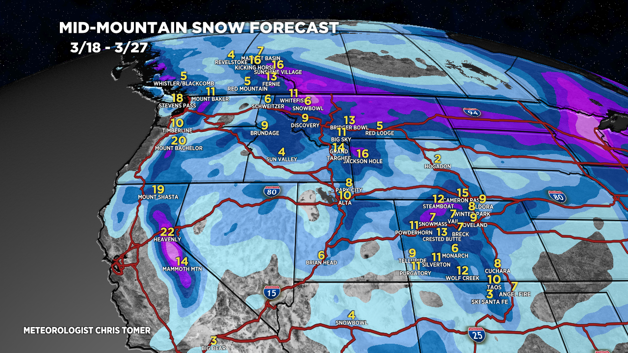
Tomer’s Take: The waiting game continues for the Central and Northern Rockies with high pressure in control. A pattern shift occurs on/after 3/21. A single storm system and buckling jet delivers moderate to heavy snow accumulation to PNW/BC/MT/WY/ID/CA/UT/CO. A second storm system appears to be missing or much weaker.
Timing
*Updated 4:15pm 3/18/2024.
Totals trending up because 2nd storm system is back in the mix.
Sierra: Next Storm System PM 3/22-3/23.
Tetons: Light Accum 3/21, H 3/23-3/26.
Wasatch: Light Accum PM 3/21, H PM 3/22-3/26.
Colorado: Light Accum PM 3/22, H 3/23-3/27.
Banff Area: Heavy Accum 3/20-3/24.
Northeast: L/M Accum 3/18-3/21, M/H 3/23.
My afternoon forecast update video:
Current Setup
Water vapor satellite shows the cut-off low continuing to spin over the 4-Corners. Notice the high pressure over the Central and Northern Rockies.
The pattern change occurs with the two areas of low pressure over the Pacific on/after 3/21. Now it appears that only one area of low pressure survives.
Orange/red = drier air aloft.

Total Liquid From 3/13-3/15 CO Storm System
This was a warm, wet storm system. Impressive liquid totals of 1-4 inches. This fluffed up to 1-5 feet of snow accumulation.

Forecast Radar & Satellite
Forecast Totals
Grand Totals by late 3/27.


