Tomer’s Take
- A fast-moving, minor cold front races south through MT, WY, and CO through 2/11.
- High pressure anchored over CA remains formidable.
- Mostly dry weekend for the Pacific Northwest. Next storm arrives Monday.
- A larger storm system pierces the Western high pressure ridge 2/14-2/16 with snow for WA, OR, CA, ID, UT, MT, WY, CO, NM. This is not a blockbuster snowstorm for most places.
- This storm system loses some of it’s strength while breaking down the high. It could be a “one and done” storm system with high pressure rebuilding afterwards.
Infrared satellite shows the storm track and large Western high pressure.

Requests
I’ve had a few forecast requests.
- Red Mountain BC: 1-4″ between 2/14-2/16.
- Powder Mountain, UT: 1-3″ between 2/15-2/16.
- Big Sky, MT: 6-12″ between 2/14-2/16.
- Revelstoke BC: 2-6″ between 2/14-2/16. Possible active pattern 2/20-2/24.
- Dallas Peak, CO: 3-6″ on 2/16. Gusts to 40mph on 2/15-2/16.
One and Done
After the 2/14-2/16 storm system, high pressure rebuilds across the West. Below, notice the higher pressure anomalies across the West on 2/20.

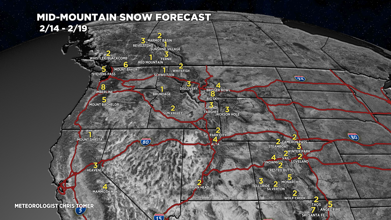
Snow Forecast
2/10-2/13:

2/14-2/19:

Northeast, 2/10-2/19:

For more analysis please watch my forecast video:
This is awesome, got hooked on your youtube videos last year. No one else puts out videos like you do. Game change. I will be @ Steamboat for president’s day weekend and then KAT skiing on 22nd. Hopefully the long rang outlook gets better! Appreciate what you do!
Thanks, Craig…my timeline for Steamboat: Snow 2/16-2/17. High pressure 2/18-2/21. Possible snow 2/22-2/24. Chris