Tomer’s Take
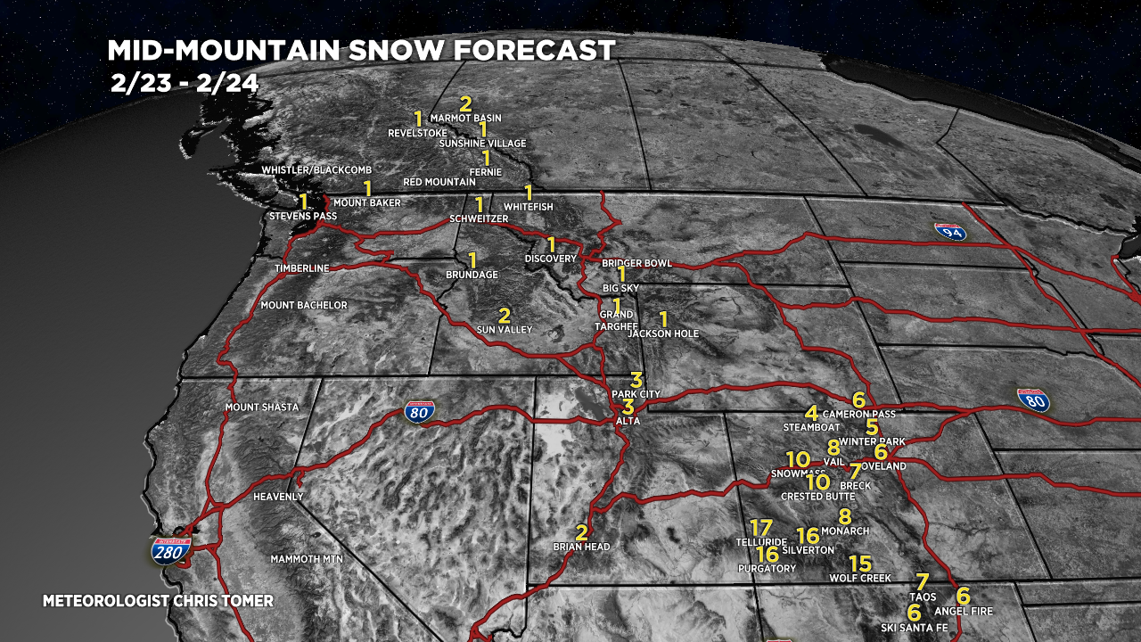
- Storm #2 is currently sliding through UT and into CO and NM with heavy additional accumulation through 2/24. My Bullseye Collection includes Crested Butte, Aspen/Snowmass, Silverton Mountain, Purgatory, Telluride, and Wolf Creek.
- Then high pressure rebuilds 2/25-3/1. Storm track shifts north and favors Pacific Northwest, British Columbia, and eventually ID, MT, and WY.
- Between 3/3-3/10 the storm track gradually shifts south and favors CA, ID, UT, MT, WY, and CO. Full details below.
Bullseye Collection in the last 48 hours:
Aspen Highlands: 25″
Crested Butte: 14″
Purgatory: 33″
Silverton Mountain: 30″
Telluride: 21″
Wolf Creek: 25″

Current Setup
Water vapor satellite shows the 2-storm combo for the West and high pressure lurking over the Pacific. Orange/red colors = drier air aloft.

Looking Down The Road
High pressure rebuilds across the West 2/25-3/1. The storm track shifts north to favor the PNW, B.C., and eventually ID, MT and WY.
After 3/3 it gradually shifts south to favor CA and the Intermountain West. Lower pressures build and reach a minimum by 3/8-3/10. This might translate into a colder, snowier pattern from CA to UT to CO.

Snow Forecast
2/23-2/24:

Zoom of Southern Colorado, 2/23-2/24:

2/25-2/28:

3/1-3/4:

Northeast, 2/23-2/28:

For more analysis please watch my forecast video:
Thanks
Thanks for this helpful information! It’s fascinating’
Thanks, Gloria! Chris
Hello Chris,
Can you tell me where I could find snow totals by day for January 2022 and February 2022 for Arvada Colorado? I’ve googled til I can’t google anymore. : ) Thanks!
Hi Marilyn – email me if this is related to an insurance case or similar. chrisdtomer@gmail.com
Chris