Tomer’s Take
- Snow continues in southern UT, CO, and NM 3/10 into early 3/11 then drier until 3/13-3/14 when a fast-moving wave of snow delivers 2-8″. That makes 3/14 a powder day.
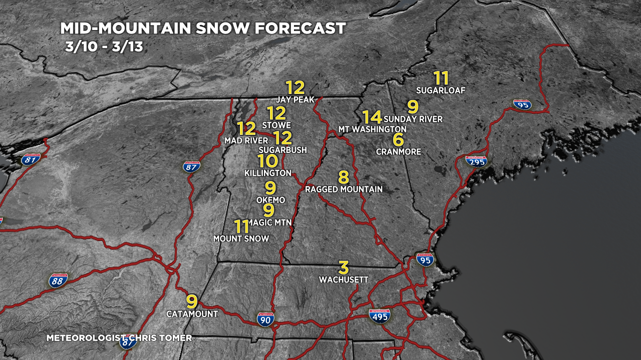
- The departing storm system from UT, CO, NM will develop into a strong Nor` Easter. Moderate to heavy snow accumulation and strong wind is likely at the major ski areas on 3/12.
- Then the storm track shifts north 3/13-3/16 favoring the Pacific Northwest, British Columbia, Idaho, Montana, and Wyoming. This is a weak atmospheric river setup. Snow levels could get pushed high.
- A larger storm system could hit California on 3/15 then slide into UT and CO on 3/16-3/17.
21″ in the last 48 hours at Steamboat Ski Resort, CO.

23″ inches in the last 48 hours at Alta, UT.

Infrared satellite shows the storm and storm system moving through UT, CO, NM. This is the storm that becomes a strong snowstorm for the Northeast on 3/12. The big low over the north Pacific is lined-up for the Pacific Northwest and British Columbia.

Northeast Snowstorm 3/12
Notice the rain/snow line cutting through parts of NH and ME on 3/12. The best odds for pure powder are VT, northern NH, and northern ME.

Snow Forecast
Northeast, 3/10-3/13:

3/10-3/15:

3/16-3/19:

For more analysis please watch my forecast video: